
Woods Hole Science Center
Title Page / Table of Contents / List of Figures / Introduction / Maps / Data Collection/Processing / Interpretation / Acknowledgments / Appendix 1 / Appendix 2 / Appendix 3 / Appendix 4
 |
 |
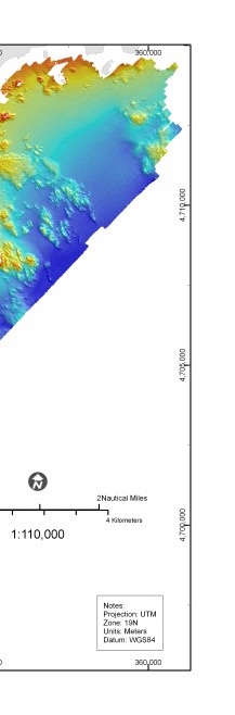 |
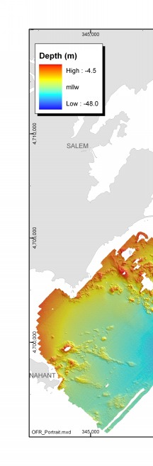
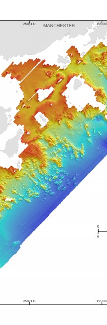
Figure 3.2. Shaded-relief map of seafloor topography offshore of northeastern Massachusetts between Nahant and Gloucester. | ||


