
Woods Hole Science Center
Surficial Geology in Central Narragansett Bay, Rhode Island: Interpretations of Sidescan Sonar and Multibeam Bathymetry
![]() Title |
Introduction |
Geologic Setting |
Data Acquisition/Processing |
Multibeam Bathymetry |
Sidescan Sonar |
Sediment Distribution |
Environments |
Summary |
GIS Data Catalog |
Acknowledgments |
References |
Figures |
Contacts
Title |
Introduction |
Geologic Setting |
Data Acquisition/Processing |
Multibeam Bathymetry |
Sidescan Sonar |
Sediment Distribution |
Environments |
Summary |
GIS Data Catalog |
Acknowledgments |
References |
Figures |
Contacts
 |
||
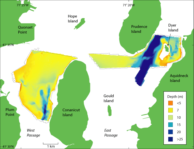
Figure 3. Bathymetry map of study areas. Depth is in meters and represents mean lower low water. | ||

