Woods Hole Science Center

Sea-Floor Character and Sedimentary Processes in the Vicinity of Woods Hole, Massachusetts
![]() Title | Abstract | Introduction | Setting | Methods | Bathymetry and Backscatter | Seismic Profiles | Character and Processes | Data Catalog | Acknowledgments | References | Figures | Bottom Photography | Sediment Data | Contacts
Title | Abstract | Introduction | Setting | Methods | Bathymetry and Backscatter | Seismic Profiles | Character and Processes | Data Catalog | Acknowledgments | References | Figures | Bottom Photography | Sediment Data | Contacts
 |
||
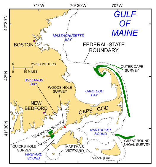
Figure 1. Index map of Cape Cod and southeastern Massachusetts showing location of the study area (red polygon). Also shown are the locations of earlier studies (Outer Cape Survey: Poppe and others, 2006; Quicks Hole Survey: Poppe and others, 2007a; Great Round Shoal Survey: Poppe and others, 2007b) completed as part of this series (green polygons). | ||