
Woods Hole Science Center
Interpolation of Reconnaissance Multibeam and Single-Beam Bathymetry Offshore of Milford, Connecticut
![]() Title |
Introduction |
Methods |
Reconnaissance Bathymetry |
Interpolated Bathymetry |
GIS Data Catalog |
Acknowledgments |
References |
List of Figures |
Contacts
Title |
Introduction |
Methods |
Reconnaissance Bathymetry |
Interpolated Bathymetry |
GIS Data Catalog |
Acknowledgments |
References |
List of Figures |
Contacts
 |
||
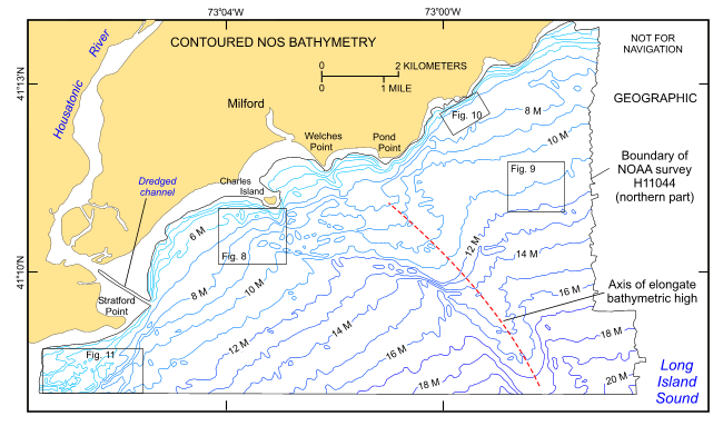
Figure 2. A portion of the 1-m contoured National Ocean Survey (NOS) bathymetry from DiGiacomo-Cohen and others (1998) showing the bathymetry within the boundary of National Oceanic and Atmospheric Administration survey H11044 off Milford, Connecticut. Map also shows the locations of the detailed views from figs. 8, 9, 10, and 11 and the axis of the elongate bathymetric high. | ||


