
Woods Hole Science Center
Interpolation of Reconnaissance Multibeam and Single-Beam Bathymetry Offshore of Milford, Connecticut
![]() Title |
Introduction |
Methods |
Reconnaissance Bathymetry |
Interpolated Bathymetry |
GIS Data Catalog |
Acknowledgments |
References |
List of Figures |
Contacts
Title |
Introduction |
Methods |
Reconnaissance Bathymetry |
Interpolated Bathymetry |
GIS Data Catalog |
Acknowledgments |
References |
List of Figures |
Contacts
 |
||
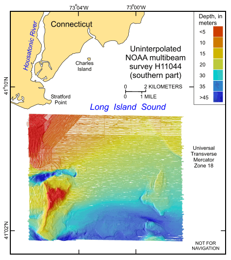
Figure 4. Image showing the original uninterpolated reconnaissance multibeam bathymetry from the southern part of National Oceanic and Atmospheric Administration survey H11044 in north-central Long Island Sound off Milford, Connecticut. | ||


