
Woods Hole Science Center
Enhanced Sidescan-Sonar Imagery, North-Central Long Island Sound
![]() Title |
Introduction |
Data Acquisition |
Processing of Sidescan Sonar |
GIS Data Catalog |
Acknowledgments |
References |
Figures |
Contacts
Title |
Introduction |
Data Acquisition |
Processing of Sidescan Sonar |
GIS Data Catalog |
Acknowledgments |
References |
Figures |
Contacts
 |
||
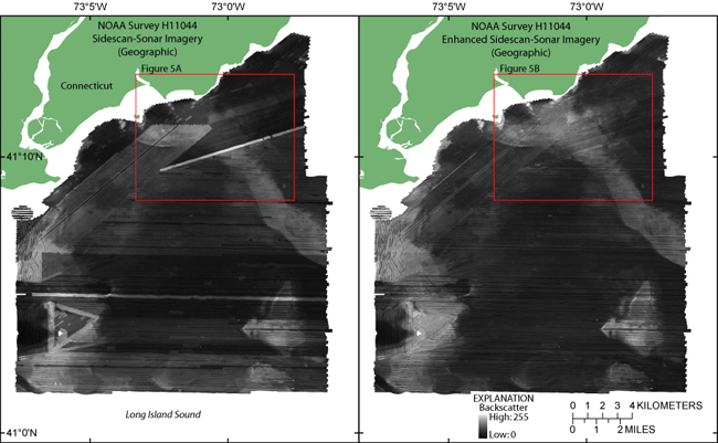
Figure 4. Sidescan-sonar imagery of National Oceanic and Atmospheric Administration survey H11044 (left) and enhanced imagery (right). Lighter tones represent higher backscatter, and darker tones represent lower backscatter. Images are in geographic coordinate system. Red rectangles show locations of images in fig. 5. | ||


