
Woods Hole Science Center
![]() Title |
Introduction |
Geologic Setting |
Data Acquisition/Processing |
Bathymetry |
Seismic-Reflection Data |
Sidescan-Sonar Imagery |
Environments |
Sea-Floor Geology |
Summary |
GIS Data Catalog |
Acknowledgments |
References Cited |
Figures |
Contacts
Title |
Introduction |
Geologic Setting |
Data Acquisition/Processing |
Bathymetry |
Seismic-Reflection Data |
Sidescan-Sonar Imagery |
Environments |
Sea-Floor Geology |
Summary |
GIS Data Catalog |
Acknowledgments |
References Cited |
Figures |
Contacts
 |
||
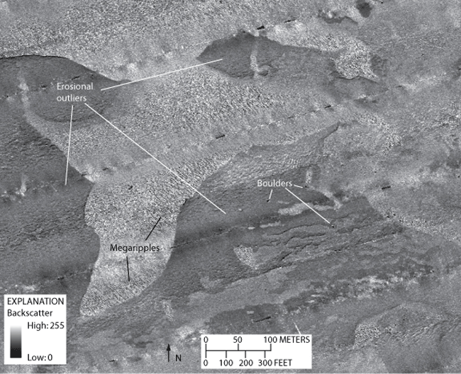
Figure 11. Detailed sidescan-sonar image showing erosional outliers in the northwestern part of the study area. Erosional outliers are characterized by low backscatter, presumably representing fine-grained fluvial and estuarine sediment, which form small plateaus about 1 meter high. Areas of high backscatter and megaripples are found between the erosional outliers. Location of image shown in figure 2. | ||

