
Woods Hole Science Center
![]() Title |
Introduction |
Geologic Setting |
Data Acquisition/Processing |
Bathymetry |
Seismic-Reflection Data |
Sidescan-Sonar Imagery |
Environments |
Sea-Floor Geology |
Summary |
GIS Data Catalog |
Acknowledgments |
References Cited |
Figures |
Contacts
Title |
Introduction |
Geologic Setting |
Data Acquisition/Processing |
Bathymetry |
Seismic-Reflection Data |
Sidescan-Sonar Imagery |
Environments |
Sea-Floor Geology |
Summary |
GIS Data Catalog |
Acknowledgments |
References Cited |
Figures |
Contacts
 |
||
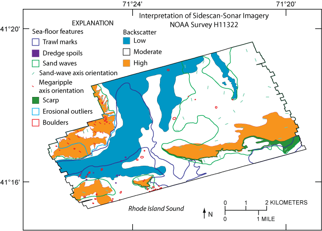
Figure 9. Interpretation of sidescan-sonar imagery of study area including low, moderate, and high backscatter; sand waves; sand-wave and megaripple axis orientation; scarps; erosional outliers; boulders; trawl marks; and dredge spoils. Location of study area shown in figure 1. | ||

