USGS Coastal and Marine Hazards and Resources Program
Geophysical Data from Offshore of the Chandeleur Islands, Eastern Mississippi Delta
|
1. Data Access
Selected raster and vector data can be viewed within an ArcView® 3.2 project (2008-1195.apr ) or an ArcMap™ 9.2 map document (2008-1195.mxd). Refer to the “Raster and Vector Data Description” section below for details on file descriptions and locations. Projection: The base-map data in this report are provided for reference purposes in their original format and coordinate system as published by the Louisiana Oil Spill Coordinator's Office (LOSCO). See the “Basemaps” folder below for a description of these data. Viewing the data:
Viewing the map documents: Data download: Raster grids are stored as Binary ESRI® grid format in the GIS_Catalog (including the GIS_Catalog.zip file) and as ASCII raster files within individual data set zip files. The ASCII raster files can be converted easily to ESRI® grid format in either ArcView with Spatial Analyst extension (Import Data Source: ASCII Raster) or ArcGIS® with Spatial Analyst extension (ASCII to Raster). Vector data are stored as shapefiles within the zip file. If WinZip® is not currently installed on the local system, go to WinZip® <http://www.winzip.com> to download the latest version of the WinZip® utility. |
||||||||||||||||||||||||||||||||||||||||||||||||||||||||||||||||||||||||||||||||||||||||||||||||||||||||||||||||||||||||||||||||||||||||||
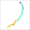
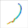
2. Raster and Vector Data Description This section describes the location of the raster and vector data within the folder storage structure of the DVD or Web page. Raster data are delivered as image files, ESRI® Binary Grids, or ASCII Grids. Vector data are delivered as ESRI® Shapefiles. Grid: floating point ASCII with ESRI® header (individual dataset zip files) and ESRI® binary grid on disc and GIS_Catalog.zip file. Image: binary image (TIFF, GeoTIFF, JPEG, MrSID). Shape file: ESRI® file format for point, polyline, or polygon vector data. Layer: ESRI® symbology file. This folder contains:
Map documents: 2008-1195.apr – ArcView® 3.2 document containing selected data layers described above. 2008-1195.mxd – ArcMap™ 9.2 map document containing selected data layers described above. 3. Data Preview Downloading data:
|
|||||||||||||||||||||||||||||||||||||||||||||||||||||||||||||||||||||||||||||||||||||||||||||||||||||||||||||||||||||||||||||||||||||||||||