Citation:
Citation_Information:
Originator: Samuel Y. Johnson
Originator: Florence L. Wong
Originator: Eleyne L. Phillips
Publication_Date: 2012
Title: Depth to transition--Santa Barbara Channel, California
Geospatial_Data_Presentation_Form: GeoTiff
Series_Information:
Series_Name: Data Series
Issue_Identification: DS 781
Publication_Information:
Publication_Place: Reston, VA
Publisher: U.S. Geological Survey
Online_Linkage: https://doi.org/10.3133/ds781
Online_Linkage:
Larger_Work_Citation:
Citation_Information:
Originator: Nadine E. Golden
Publication_Date: 2013
Title: California State Waters Map Series Data Catalog
Geospatial_Data_Presentation_Form: database
Series_Information:
Series_Name: Data Series
Issue_Identification: DS 781
Publication_Information:
Publication_Place: Reston, VA
Publisher: U.S. Geological Survey
Online_Linkage: https://doi.org/10.3133/ds781
Description:
Abstract:
This part of DS 781 presents data for the depth-to-transition (the depth to the bedrock at the Last Glacial Maximum) map of the Santa Barbara Channel, California, region. The raster data file is included in "DepthToTransition_SantaBarbaraChannel.zip," which is accessible from
https://pubs.usgs.gov/ds/781/SantaBarbaraChannel/data_catalog_SantaBarbaraChannel.html.
As part of the USGS's California Seafloor Mapping Project, a 50-m-resolution grid of depth to the transgressive surface of the Last Glacial Maximum within California State Waters between Refugio Beach and the Hueneme Canyon and vicinity map area was generated from seismic-reflection data collected in 2007 and 2008 (USGS activities Z-3-07-SC and S-7-08-SC), supplemented with outcrop and geologic structure data from DS 781. The resulting sediment-thickness grid was subtracted from regional bathymetry to determine the depth to the last glacial maximum transitional surface. The resulting grid covers an area of approximately 600 sq km. Contours at 5-meter intervals were derived from this depth-to-transition grid and are also available in this data release.
These data are intended for science researchers, students, policy makers, and the general public. This information is not intended for navigational purposes.The data can be used with geographic information systems (GIS) software to display geologic and oceanographic information.
Supplemental_Information:
Time_Period_of_Content:
Time_Period_Information:
Range_of_Dates/Times:
Beginning_Date: 2005
Ending_Date: 2009
Currentness_Reference: ground condition
Status:
Progress: Complete
Maintenance_and_Update_Frequency: None planned
Spatial_Domain:
Bounding_Coordinates:
West_Bounding_Coordinate: -120.206232
East_Bounding_Coordinate: -119.123028
North_Bounding_Coordinate: 34.492447
South_Bounding_Coordinate: 34.027787
Keywords:
Theme:
Theme_Keyword_Thesaurus: USGS Metadata Identifier
Theme_Keyword: USGS:d4b38aa8-3a29-4b10-aec8-84ce9bb1d5d9
Theme:
Theme_Keyword_Thesaurus: USGS Thesaurus
Theme_Keyword: marine geology
Theme_Keyword: seismic reflection methods
Theme_Keyword: maps and atlases
Theme_Keyword: stratigraphic thickness
Theme_Keyword: geospatial datasets
Theme:
Theme_Keyword_Thesaurus: None
Theme_Keyword: coastal geology
Theme_Keyword: sediment thickness
Theme_Keyword: sediment isopach
Theme_Keyword: U.S. Geological Survey
Theme_Keyword: USGS
Theme_Keyword: Coastal and Marine Hazards and Resources Program
Theme_Keyword: CMHRP
Theme_Keyword: Pacific Coastal and Marine Science Center
Theme_Keyword: PCMSC
Theme:
Theme_Keyword_Thesaurus: Marine Realms Information Bank (MRIB) keywords
Theme_Keyword: sediment deposition
Theme_Keyword: seismic reflection profiling
Theme:
Theme_Keyword_Thesaurus: ISO 19115 Topic Category
Theme_Keyword: environment
Theme_Keyword: geoscientificInformation
Theme_Keyword: oceans
Theme:
Theme_Keyword_Thesaurus: Data Categories for Marine Planning
Theme_Keyword: Physical Habitats and Geomorphology
Theme_Keyword: Distributions
Place:
Place_Keyword_Thesaurus: Geographic Names Information System
Place_Keyword: Pacific Ocean
Place_Keyword: Santa Barbara Channel
Place_Keyword: Hueneme Canyon
Place_Keyword: Ventura
Place_Keyword: Carpinteria
Place_Keyword: Santa Barbara
Place_Keyword: Coal Oil Point
Place_Keyword: Refugio Beach
Place_Keyword: California
Place_Keyword: USA
Access_Constraints: none
Use_Constraints:
USGS-authored or produced data and information are in the public domain from the U.S. Government and are freely redistributable with proper metadata and source attribution. Please recognize and acknowledge the U.S. Geological Survey as the originator(s) of the dataset and in products derived from these data. This information is not intended for navigation purposes.
Point_of_Contact:
Contact_Information:
Contact_Organization_Primary:
Contact_Organization:
U.S. Geological Survey, Pacific Coastal and Marine Science Center
Contact_Person: PCMSC Science Data Coordinator
Contact_Address:
Address_Type: mailing and physical
Address: 2885 Mission Street
City: Santa Cruz
State_or_Province: CA
Postal_Code: 95060-5792
Country: US
Contact_Voice_Telephone: 831-427-4747
Contact_Electronic_Mail_Address: [email protected]
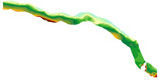
Browse_Graphic:
Browse_Graphic_File_Name:
Browse_Graphic_File_Description:
Map showing the depth-to-transition surface for the Santa Barbara Channel, California, map region
Browse_Graphic_File_Type: JPEG
Native_Data_Set_Environment:
Microsoft Windows XP Version 5.1 (Build 2600) Service Pack 3; ESRI ArcCatalog 9.3.1.3000