In accordance with SO #3423 - The Gulf of America and SO #3424 - Mount McKinley and Landmarks Honoring the Alaskan People, new USGS data releases specific to those named places will utilize the new name Gulf of America and the restored name Mount McKinley. Per USGS practice, historical data will retain the name of the geographic features as they were known at the time the data were originally released.
High-resolution geophysical data collected in the Madison Swanson and Steamboat Lumps Marine Protected Areas, Gulf of Mexico in 2000, U.S. Geological Survey Field Activity 2000-005-FA
| Field activity number | 2000-005-FA |
|---|---|
| Version | 1 |
| Area of operation | Gulf of Mexico |
| Dates | 2000 |
| Chief scientist | Kathryn M. Scanlon |
Suggested citation: Scanlon, K.M., and Buczkowski, B.J., 2016, High-resolution geophysical data collected in the Madison Swanson and Steamboat Lumps Marine Protected Areas, Gulf of Mexico in 2000, U.S. Geological Survey Field Activity 2000-005-FA: U.S. Geological Survey data release, https://doi.org/10.5066/F7JD4TVC
Abstract: The U.S. Geological Survey (USGS) mapped approximately 22 square miles of the Madison Swanson Marine Protected Area (MPA) and Steamboat Lumps MPA, which are located on the Florida shelf edge in the northeastern Gulf of Mexico in 2000 using sidescan sonar and high-resolution chirp seismic-reflection systems. This survey was conducted as part of a larger study of the effectiveness of no-fishing reserves in protecting grouper spawning aggregations. Field activity information for this cruise is available on-line through the U.S. Geological Survey Coastal and Marine Geoscience Data System at https://cmgds.marine.usgs.gov/fan_info.php?fa=2000-005-FA.
Filename and description |
Preview |
Metadata |
Download |
|---|---|---|---|
| 2000-005-FA_DATA This .zip file contains all available datasets collected from USGS field activity 2000-005-FA with the exception of chirp subbottom data, which are available in USGS Open-File Report 2002-45 |
2000-005-FA_DATA.zip 448.46 MB |
||
Seismic |
|||
| 2000-005-FA_chirp Archive of Chirp Subbottom Data Collected During USGS Cruise ORGN00005, Northeastern Gulf of Mexico, 15 February - 2 March, 2000. These data have already been published as USGS Open-File Report 2002-45 and are available online through the USGS Publications Warehouse. |
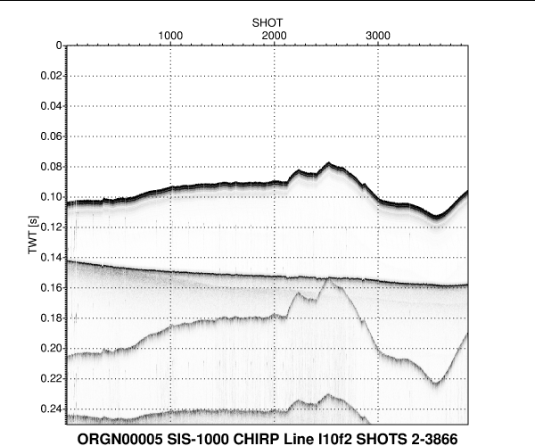 |
Metadata and data are available to download directly from USGS Open-File Report 2002-45. Capone, M.K., Swift, B.A., and Scanlon, K.M., 2002, Archive of chirp subbottom data collected during USGS cruise ORGN00005, northeastern Gulf of Mexico, 15 February-2 March 2000: U.S. Geological Survey Open-File Report 2002-45. Avalable online: https://pubs.er.usgs.gov/publication/ofr0245(data) |
|
| 2000-005-FA_boomer These data are not available. Due to equipment failure at sea and the poor quality of the few boomer seismic data that were collected for this field activity, none of the data were preserved. |
no preview available | not available | (data) |
Backscatter |
|||
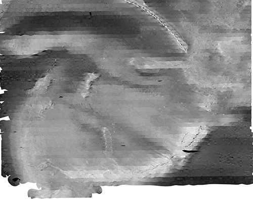
| 2000-005-FA_ctrl_sss Georeferenced TIFF image displaying 2 meter resolution backscatter data collected by the U.S. Geological Survey in a subset of the Steamboat Lumps marine Protected Area, Gulf of Mexico in 2000 (UTM Zone 16, WGS 84, GeoTIFF image) |
HTML TEXT XML |
2000-005-FA_ctrl_sss.zip 3.87 MB |
|
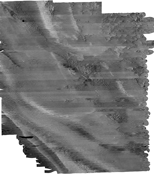
| 2000-005-FA_MS_sss Georeferenced TIFF image displaying 1 meter resolution backscatter data collected by the U.S. Geological Survey in the Madison Swanson Marine Protected Area, Gulf of Mexico in 2000 (UTM Zone 16, WGS 84, GeoTIFF image) |
 |
HTML TEXT XML |
2000-005-FA_MS_sss.zip 191.08 MB |
| 2000-005-FA_SL_sss Georeferenced TIFF image displaying 1 meter resolution backscatter data collected by the U.S. Geological Survey in the Steamboat Lumps Marine Protected Area, Gulf of Mexico in 2000 (UTM Zone 16, WGS 84, GeoTIFF image) |
 |
HTML TEXT XML |
2000-005-FA_SL_sss.zip 234.53 MB |
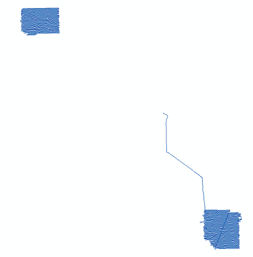
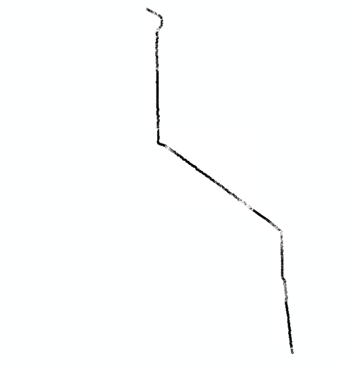
| 2000-005-FA_sss_linenav Sidescan Sonar polyline shapefile of trackline navigation files collected by the U.S. Geological Survey in the Madison Swanson and Steamboat Lumps Marine Protected Areas, Gulf of Mexico in 2000 (Geographic, WGS 84) |
 |
HTML TEXT XML |
2000-005-FA_sss_linenav.zip .229 MB |
| 2000-005-FA_sss_nav Sidescan Sonar Navigation point shapefile and ASCII navigation files collected by the U.S. Geological Survey in the Madison Swanson and Steamboat Lumps Marine Protected Areas, Gulf of Mexico in 2000 (Geographic, WGS 84) |
 |
HTML TEXT XML |
2000-005-FA_sss_nav.zip .559 MB |
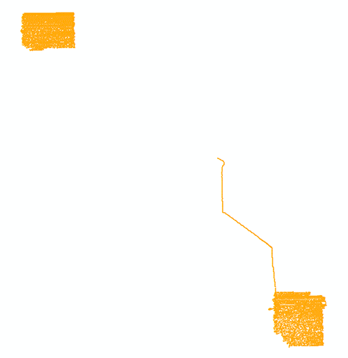
| 2000-005-FA_transit_sss Georeferenced TIFF images displaying backscatter data collected by the U.S. Geological Survey along the transit between the Madison Swanson and Steamboat Lumps Marine Protected Areas, Gulf of Mexico in 2000 (UTM Zone 16, WGS 84, 5 GeoTIFF images) |
 |
HTML TEXT XML |
2000-005-FA_transit_sss.zip 1.25 MB |
Navigation | |||
| 2000-005-FA_hypack HYPACK ASCII navigation files collected by the U.S. Geological Survey in the Madison Swanson and Steamboat Lumps Marine Protected Areas, Gulf of Mexico in 2000 (Geographic, WGS 84) |
no preview available | HTML TEXT XML |
2000-005-FA_hypack.zip 14.49 MB |
Log Files |
| 2000-005-FA_logbooks Acquisition logs maintained on U.S. Geological Survey Field Activity 2005-005-FA in the Gulf of Mexico in 2000 (PDF and Excel spreadsheet formats) |
no preview available | HTML TEXT XML |
2000-005-FA_logbooks.zip 2.68 MB |