

|
Vedanta Ranch TrenchClick on images for larger view
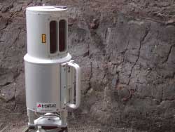
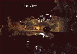
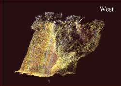
Field Methods: We used the Riegl Z210i tripod-mounted LiDAR system of the Geo-Engineering Laboratory of the USGS Coastal and Marine Team at Vedanta Ranch at Olema Hill. Here, the LiDAR is set up inside the trench to image the exposed fault. The unit weighs 13 kg, is rugged, and highly portable. The upper right image is a LiDAR plan view of the trench. The circular nadir is the set up location of the tripod. At these distances we can resolve features to <1cm, such that trench walk planks, tools, and pump hoses are clearly visible in the image.
|
|||||||||||
|
Abstract | Vedanta Ranch Trench | Color Channel & Intensity Models of the Trench Wall | Olema Ridge Trench
|
||||||||||||
geotech/olema/vedanta.html
contact: Robert Kayen
last modified 2018
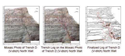 Traditional photo interpretation of the trench wall.


