
Preliminary Analysis of Sedimentary Deposits
from the June 23, 2001 Peru Tsunami
[ Introduction | Team | Importance of Studying Tsunami Sediments | Survey and Methods | Damage | Run-up | Sedimentary Deposits | Preliminary Results | Future Research | Acknowledgments ]
Tsunami Run-up
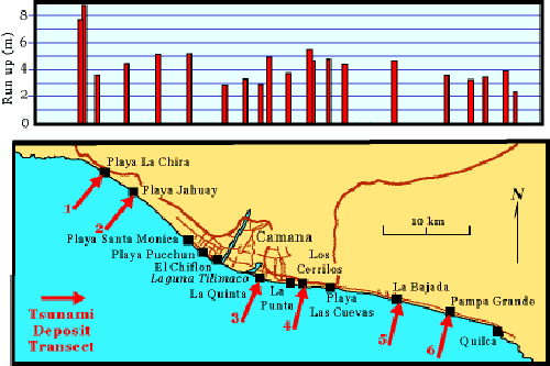
Run-up measurements from the first ITST and from this survey, plotted on graph above a map of the southern Peruvian coast near Camaná, approximately 700 km (435 miles) southeast of Lima, Peru. Map also shows the location of the six sites tsunami deposit transects were measured during this survey: (1) Playa la Chira, (2) Playa Jahuay, (3) La Quinta, (4) Amecosupe, (5) La Bajada, and (6) Pampa Grande. Modified from figure courtesy of Jose Borero.
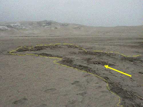
The limit of tsunami inundation was marked by lines of woody debris and often followed lows in topography, as seen on the beach at Pampa Grande.
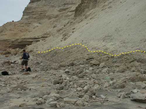
The inundation line at Playa la Chira is marked by a line of debris and a color change on the slope above the beach. The highest run-up measured by the survey (8.2 m) was along this stretch of beach.