
Preliminary Analysis of Sedimentary Deposits
from the June 23, 2001 Peru Tsunami
[ Introduction | Team | Importance of Studying Tsunami Sediments | Survey and Methods | Damage | Run-up | Sedimentary Deposits | Preliminary Results | Future Research | Acknowledgments ]
Survey and Methods
USGS and Peruvian scientists measured tsunami sediment thickness, run-up, inundation distance, and topographic profiles for six shore-normal transects along 50 km of coastline in the vicinity of Camaná, Peru. More than 120 samples were collected for laboratory analyses for grain size distribution, microfossils, mineralogy, and chemistry. Sedimentary characteristics of the tsunami deposits and underlying material were logged and photo-documented. Box cores and sediment peels were taken at several sites to preserve the stratigraphy of the sediments. Erosion, flow-direction indicators, water marks on buildings, and damage to structures were also documented. Local residents were interviewed for their observations of the tsunami and local conditions before and after the tsunami. In addition to participating in the field survey, our Peruvian colleagues provided maps, supplied photographs taken before and shortly after the tsunami, and were invaluable for their knowledge of the area.
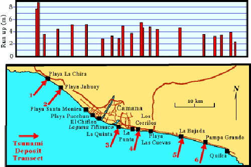
Location of Tsunami Deposit Transects along the southern Peruvian coast near Camaná, approximately 700 km (435 miles) southeast of Lima, Peru. Transects were made at six sites: (1) Playa la Chira, (2) Playa Jahuay, (3) La Quinta, (4) Amecosupe, (5) La Bajada, and (6) Pampa Grande. Run-up measurements, plotted on the graph above the map, include measurements from this survey and the 1st ITST. Modified from figure courtesy of Jose Borero.
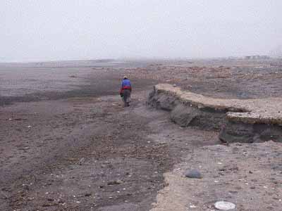
Some locations exhibited significant erosion as a result of the tsunami, such as this stretch of coast near Amecosupe.
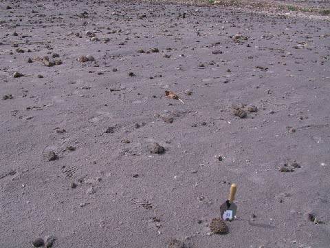
The tsunami was capable of transporting large material considerable distances inland, such as these cobbles in a field at La Quinta. Large mud clasts ripped up from the agricultural fields are also present at the surface.
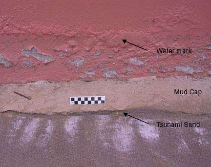
Tsunami-deposited sand with mud cap on floor of damaged building at Las Cuevas. Note water mark on wall.
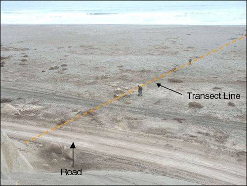
La Bajada Transect. Tsunami crossed road in foreground of this photograph.
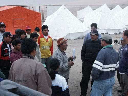
Discussing our project with the local residents and interviewing eye-witnesses was an important part of our work.
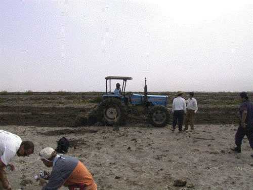
It is necessary to document sedimentary deposits as soon after the tsunami as possible, for the need to rebuild communities and reestablish agricultural areas will often destroy valuable data. Many inundated farmlands had already been plowed before the survey team arrived and others were plowed during or soon after the survey collected data.
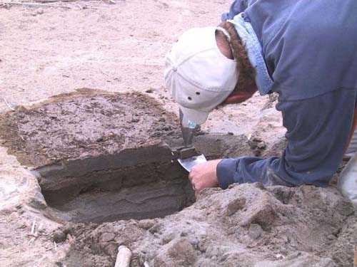
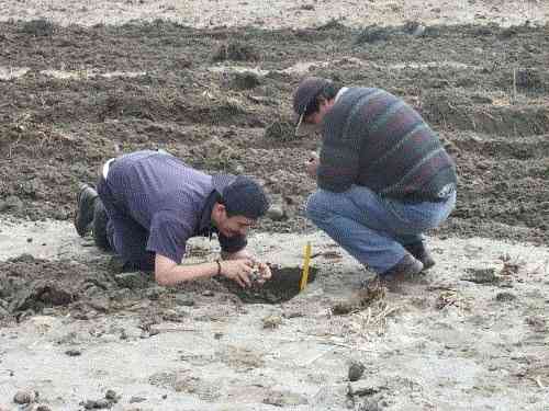
Taking sediment samples for grain-size analysis, microfossils, mineralogy, and chemistry.
Photographing the deposits.
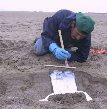
Making sediment peels.