
Woods Hole Science Center
![]() Title |
Introduction |
Setting |
Methods |
Overview |
Interpretation |
Discussion |
Data Catalog |
Acknowledgments |
References |
Figures |
Bottom Photographs |
Sediment Data |
Contacts
Title |
Introduction |
Setting |
Methods |
Overview |
Interpretation |
Discussion |
Data Catalog |
Acknowledgments |
References |
Figures |
Bottom Photographs |
Sediment Data |
Contacts
 |
||
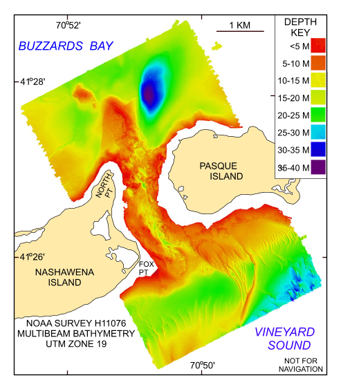
Figure 19. Digital terrain model (DTM) of the sea floor produced from multibeam bathymetry collected during NOAA survey H11076 of Quicks Hole, Massachusetts. Image is sun-illuminated from the north and vertically exaggerated 5x. Hotter colors are shallower areas; cooler colors are deeper areas. See key for depth ranges. | ||


