
Woods Hole Science Center
![]() Title |
Introduction |
Setting |
Methods |
Overview |
Interpretation |
Discussion |
Data Catalog |
Acknowledgments |
References |
Figures |
Bottom Photographs |
Sediment Data |
Contacts
Title |
Introduction |
Setting |
Methods |
Overview |
Interpretation |
Discussion |
Data Catalog |
Acknowledgments |
References |
Figures |
Bottom Photographs |
Sediment Data |
Contacts
 |
||
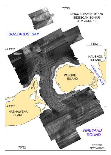
Figure 20. Map showing the sidescan sonar imagery produced from data collected during NOAA survey H11076 of Quicks Hole, Massachusetts. Light tones are hard returns and generally coarser grained sediments; dark tones are softer returns and generally finer grained sediments. | ||


