
Woods Hole Science Center
Sea-Floor Character and Sedimentary Processes of Great Round Shoal Channel, Offshore Massachusetts
![]() Title |
Introduction |
Setting |
Methods |
Overview |
Discussion |
Interpretation |
Data Catalog |
Acknowledgments |
References |
Figures |
Bottom Photographs |
Sediment Data |
Contacts
Title |
Introduction |
Setting |
Methods |
Overview |
Discussion |
Interpretation |
Data Catalog |
Acknowledgments |
References |
Figures |
Bottom Photographs |
Sediment Data |
Contacts
 |
||
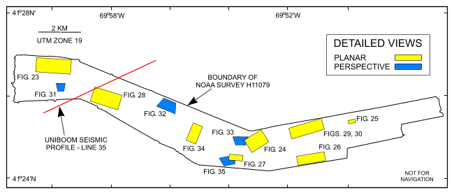
Figure 22. Map showing the boundary of the acoustic data from NOAA survey H11079 of Great Round Shoal Channel and the locations of the detailed planar, perspective, and comparative views of the multibeam DTM and sidescan-sonar mosaic shown in other figures, and the seismic profile shown in figure 2. | ||


