
Woods Hole Science Center
Sea-Floor Character and Sedimentary Processes of Great Round Shoal Channel, Offshore Massachusetts
![]() Title |
Introduction |
Setting |
Methods |
Overview |
Discussion |
Interpretation |
Data Catalog |
Acknowledgments |
References |
Figures |
Bottom Photographs |
Sediment Data |
Contacts
Title |
Introduction |
Setting |
Methods |
Overview |
Discussion |
Interpretation |
Data Catalog |
Acknowledgments |
References |
Figures |
Bottom Photographs |
Sediment Data |
Contacts
 |
||
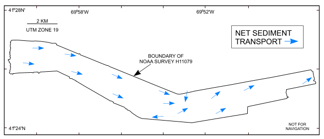
Figure 42. Map showing the interpreted directions of net sediment transport (blue arrows). Interpretation is based on the orientation and asymmetry of sand waves and scour marks. Note that sediment transport is generally to the east. | ||


