
Woods Hole Science Center
Sea-Floor Character and Sedimentary Processes of Great Round Shoal Channel, Offshore Massachusetts
![]() Title |
Introduction |
Setting |
Methods |
Overview |
Discussion |
Interpretation |
Data Catalog |
Acknowledgments |
References |
Figures |
Bottom Photographs |
Sediment Data |
Contacts
Title |
Introduction |
Setting |
Methods |
Overview |
Discussion |
Interpretation |
Data Catalog |
Acknowledgments |
References |
Figures |
Bottom Photographs |
Sediment Data |
Contacts
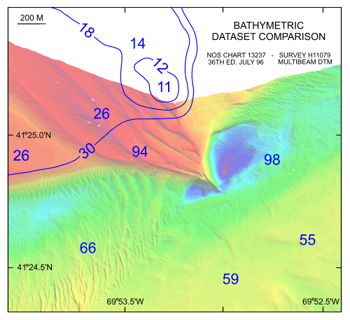 | ||
Figure 43. Detailed comparative view of the new multibeam bathymetric dataset with contours and soundings from chart 13237 (NOAA, 1996) that was based on bathymetry from a 1954 survey (H08171). Note that the southeastern tip of Great Round Shoal and its associated scour depressions have migrated dramatically to the southeast. Depth key for multibeam bathymetry is shown in figure 20. | ||


