
Woods Hole Science Center
Sidescan-Sonar Imagery, Multibeam Bathymetry, and Surficial Geologic Interpretations of the Sea Floor in Rhode Island Sound, off Sakonnet Point, Rhode Island
![]() Title |
Introduction |
Geologic Setting |
Data Acquisition/Processing |
Bathymetry |
Sidescan-Sonar Imagery |
Environments |
Discussion |
Summary |
GIS Data Catalog |
Acknowledgments |
References |
Figures |
Contacts
Title |
Introduction |
Geologic Setting |
Data Acquisition/Processing |
Bathymetry |
Sidescan-Sonar Imagery |
Environments |
Discussion |
Summary |
GIS Data Catalog |
Acknowledgments |
References |
Figures |
Contacts
 |
||
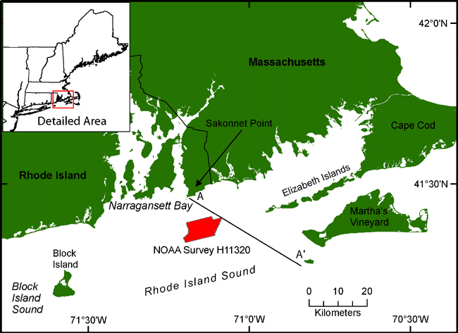
Figure 1. Location map of NOAA Survey H11320 (red polygon) in Rhode Island Sound. Location of stratigraphy profile A-A' from figure 3 is also shown. | ||

