
Woods Hole Science Center
Sidescan-Sonar Imagery, Multibeam Bathymetry, and Surficial Geologic Interpretations of the Sea Floor in Rhode Island Sound, off Sakonnet Point, Rhode Island
![]() Title |
Introduction |
Geologic Setting |
Data Acquisition/Processing |
Bathymetry |
Sidescan-Sonar Imagery |
Environments |
Discussion |
Summary |
GIS Data Catalog |
Acknowledgments |
References |
Figures |
Contacts
Title |
Introduction |
Geologic Setting |
Data Acquisition/Processing |
Bathymetry |
Sidescan-Sonar Imagery |
Environments |
Discussion |
Summary |
GIS Data Catalog |
Acknowledgments |
References |
Figures |
Contacts
 |
||
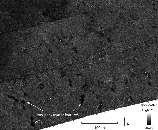
Figure 13. Detailed area of sidescan-sonar image showing low-backscatter targets. These features show no relief in the bathymetry data and are thought to be patches of fine-grained sediment within larger areas of coarser grained sediment. Figure location shown in figure 2. | ||

