
Woods Hole Science Center
Sidescan-Sonar Imagery, Multibeam Bathymetry, and Surficial Geologic Interpretations of the Sea Floor in Rhode Island Sound, off Sakonnet Point, Rhode Island
![]() Title |
Introduction |
Geologic Setting |
Data Acquisition/Processing |
Bathymetry |
Sidescan-Sonar Imagery |
Environments |
Discussion |
Summary |
GIS Data Catalog |
Acknowledgments |
References |
Figures |
Contacts
Title |
Introduction |
Geologic Setting |
Data Acquisition/Processing |
Bathymetry |
Sidescan-Sonar Imagery |
Environments |
Discussion |
Summary |
GIS Data Catalog |
Acknowledgments |
References |
Figures |
Contacts
 |
||
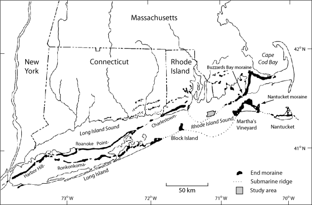
Figure 4. Map showing the location of end moraines (solid black polygons) in southern New England and New York . The Ronkonkoma-Nantucket moraine shows the maximum extent of the Laurentide ice sheet 20 ka, while the Harbor Hill-Roanoke Point-Charlestown-Buzzards Bay moraine shows a retreated position of the ice sheet around 18 ka (Uchupi and others, 1996). Submarine ridges (dotted lines) mark the underwater extensions of the moraines. H11320 study area shown as a gray polygon. Modified from Gustavson and Boothroyd (1987). | ||

