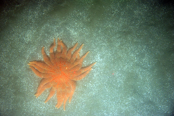
Photograph of the seafloor off the California coast shows coarse sand, shells and a sunflower sea star. This photograph supports the California Seafloor Mapping Program, a cooperative program established in 2007 initiated by state and federal agencies, academia and private industry. Data collected during this project reveal the seafloor offshore of the California coast in unprecedented detail and provide an ecosystem context for the effective management of this precious marine resource. Photo Credit: USGS
The USGS has completed the second phase of releasing thousands of photos and videos of the seafloor and coastline through their Coastal and Marine Video and Photography Portal.
Most of these marine and coastal scenes have never been seen before or mapped at this level of detail. A more accurate perspective of these areas helps coastal managers make important decisions that range from protecting habitats to understanding hazards and managing land use.
This USGS portal is unique, due to the sheer quantity and quality of data presented. It is the largest database of its kind, providing detailed and fine-scale representations of the coast and seafloor. The “geospatial context” is also unique, with maps that display imagery in the geographic location where the images were recorded.
Read the rest of the USGS Science Feature titled, "Gifts from the Sea."
 Pacific Coastal and Marine Science Center presentations at the
2015 AGU Fall Meeting
Pacific Coastal and Marine Science Center presentations at the
2015 AGU Fall MeetingScientists from the Pacific Coastal and Marine Science Center plan to present 19 talks or posters at the American Geophysical Union Fall Meeting, December 14 to 18, 2015, in San Francisco. Presentation topics range from documenting rapid Alaskan coastal erosion to mapping underwater earthquake faults to debuting new tsunami scenarios. This conference is the largest meeting of earth scientists in the world, with nearly 24,000 attendees, including dozens of national and international journalists. See table below for a complete list of PCMSC presentations:
Name |
Session # |
Title |
|---|---|---|
| Brothers, Daniel | NH23B-1882 | High-resolution geophysical constraints on late Pleistocene—present deformation history, seabed morphology, and slip-rate along the Queen Charlotte-Fairweather fault, offshore southeastern Alaska |
| Campbell, Pamela | OS33A-2015 | Lipid biomarkers and carbon isotopic composition from authigenic carbonates and seep sediments from the US mid-Atlantic margin |
| East, Amy | EP33A-1027 | Synthesizing fluvial sedimentary and geomorphic response to dam removal—A two-decade perspective |
| Geist, Eric L. | NH14A-01 | Tsunami size distributions at far-field locations from aggregated earthquake sources |
| Gelfenbaum, Guy R. | EP33C-1082 | Reconstructing tsunami deposits in the eastern Aleutians using forward and inverse sediment transport models |
| Gelfenbaum, Guy R. | NH23D-02 | Using inundation and sediment transport modeling to characterize earthquake source parameters from tsunami deposits |
| Gibbs, Ann E. | C33G-02 | Measuring change in Arctic coastal environments using repeat aerial photography and SfM elevation models |
| Jaffe, Bruce E., | EP33C-1081 | Evaluating inverse models for reconstructing flow speed from sandy tsunami deposits |
| Johnson, Samuel Y. | NH21E-07 | Structure and geomorphology of the 'big bend' in the Hosgri-San Gregorio fault system, offshore of Big Sur, central California |
| Kluesner, Jared W. | T23C-2956 | 3D insight into fault geometries, deformation, and fluid-migration within the Hosgri Fault Zone offshore central California: Results from high-resolution 3D seismic data |
| Kluesner, Jared W. | OS31B-08 | High-resolution seismic attribute analysis for the detection of methane hydrate and substrate fluid migration pathways along the central U.S. Atlantic Margin |
| La Selle, SeanPaul M. | NH23D-08 | Hurricane Sandy deposits on Fire Island, NY: Using washover deposit stratigraphy to understand sediment transport during large storms |
| Maier (Coble), Katherine | EP12A-04 | Linking slope sedimentation, gradient, morphology, and active faulting: An integrated example from the Palos Verdes slope, Southern California Borderland |
| McGann, Mary | OS23C-2022 | Late Holocene record of sedimentologic and paleooceanographic events in western Guaymas Basin, Gulf of California |
| Prouty Nancy G. | B23A-0592 | Deep-sea coral record of human impact on watershed quality in the Mississippi River Basin |
| Richmond, Bruce M. | EP23A-0938 | Seasonal to decadal change of Arctic coastal bluffs, Barter Island, Alaska |
| Ross, Stephanie L. | NH23C-1895 | SAFRR tsunami scenarios and USGS-NTHMP collaboration |
| Swarzenski, Peter W. | GC54B-02 | Hydrogeology and geochemistry of the freshwater lens on Roi Namur atoll, the Republic of the Marshall Islands |
| Watt, Janet Tilden | T23C-2965 | Detailed geophysical imaging in San Pablo Bay reveals a new strand of the Hayward-Rodgers Creek fault zone |
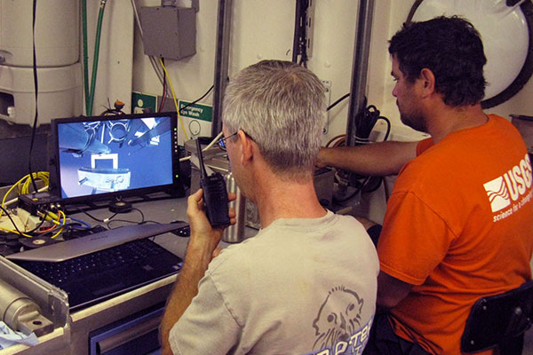
Gerry Hatcher (left) monitors the view of the seafloor from the camera mounted on the Mini Muc and communicates with the ship’s bridge while Pete Dal Ferro uses a remote winch control to position the Mini Muc and trigger coring. USGS photograph by Jenny White.
This month's cover story of the newsletter Sound Waves features Pacific Coastal and Marine Science Center Marine Facility team members Gerry Hatcher, Jenny White, and Pete Dal Ferro leading coring and video-imaging for a multi-institutional study of methane seeps on the Atlantic margin. A major focus of the cruise was piston coring directed by Jenny and Pete. And the cruise marked the first USGS deployment of a mini-multicorer, the Mini Muc, a compact, 4-core system for which Gerry designed a real-time high-definition camera system to use for selecting coring sites and archiving a video record of each site.
Read the entire article.
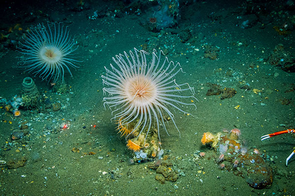
Cerianthid anemones, also known as “tube anemones,” although related, are not considered true anemones. They live in a tube they build using mucus, surrounding mud, and thread-like structures produced by their cells. The two red laser dots (to the left of the center anemone) are 10 centimeters (about 6 inches) apart. Photo credit: NOAA-OER/BOEM/USGS.
This Research article in the latest issue of the newsletter Sound Waves introduces a 24-minute video that highlights work by USGS scientists—including Pacific Coastal and Marine Science Center research oceanographer Nancy Prouty—during a five-year study of two deep submarine canyons about 100 miles off Virginia and Maryland.
Read the entire article.
Please welcome Jolene Gittens as the new editor of Sound Waves. Jolene is an information specialist at the USGS St. Petersburg Coastal and Marine Science Center in Florida who served many years as the newsletter’s web-layout editor. Assisting Jolene is current Sound Waves web-layout editor Betsy Boynton, a multimedia specialist in the St. Pete center who is now also doing the newsletter’s print layout. Laura Torresan, the web designer at the Pacific Coastal and Marine Science Center, will continue to be web-review editor.
Read the entire article.
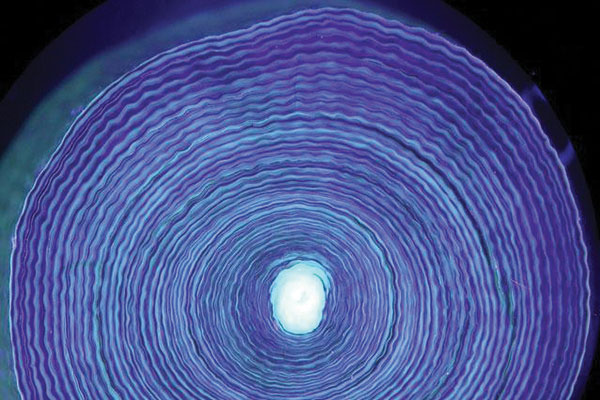
Photograph from Chapter 10 of the report: Utraviolet light illuminates the growth rings in a cross-section of a 44-year-old deep-sea coral collected off the coast of Newfoundland at 400 meters. Similar to trees, cross-sections reveal coral-growth rings. Photo by Owen Sherwood.
Two chapters by USGS scientists will soon be released as part of NOAA’s report “The State of Deep-Sea Coral and Sponge Ecosystems of the United States: 2015.” The report highlights advances in deep-sea coral research and management efforts since 2007. Research oceanographer Nancy Prouty (Pacific Coastal and Marine Science Center) is lead author of chapter 10, “Age, Growth Rates, and Paleoclimate Studies,” about slow-growing, long-lived corals whose skeletons contain a chemical record of marine climate and environmental change, making them similar to old-growth forests. Research biologist Cheryl Morrison (Leetown Science Center) is lead author of chapter 12, “Population Connectivity of Deep-Sea Corals.” These corals’ genetic similarities and dissimilarities yield clues as to how far coral larvae disperse and how quickly coral communities could recover from destructive events. For more information, contact Nancy Prouty, nprouty@usgs.gov, 831-460-7526.
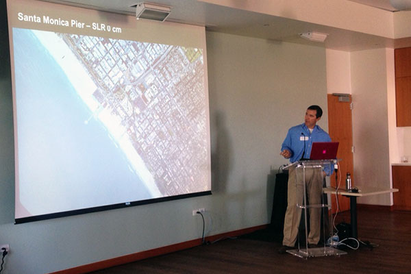
Patrick Barnard presents the initial results from the new CoSMoS 3.0 model for Southern California. Photo by Holly Rindge, USC Sea Grant.
California agencies are using the latest version of the USGS-led Coastal Storm Modeling System, CoSMoS 3.0, to plan for coastal flooding and erosion expected from El Niño storms this winter. Originally created for the USGS SAFRR ARkStorm scenario, CoSMoS projects coastal flooding and erosion due to both sea-level rise and storms driven by climate change. At the request of the California Ocean Protection Council and the Governor’s Office of Emergency Services, USGS project leader Patrick Barnard has posted the latest extreme-storm flooding projections for Southern California on the CoSMoS project web site. These projections were the subject of a workshop hosted October 21 by the University of Southern California (USC) Sea Grant and the City of Santa Monica, and they will be featured during a December 9 webinar on sponsored USC Sea Grant. For more information, contact Patrick Barnard, pbarnard@usgs.gov, 831-460-7556.
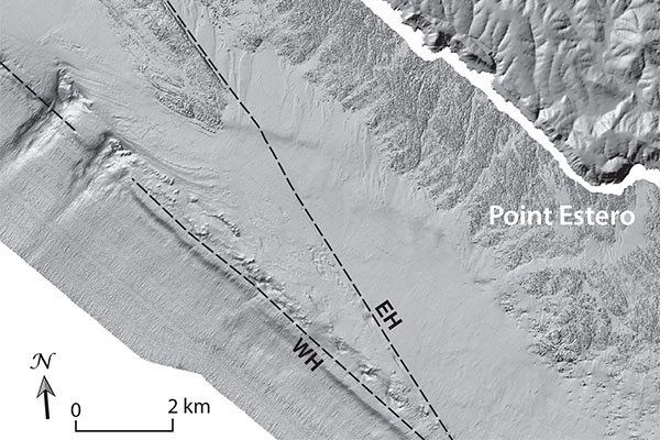
Two strands of the Hosgri fault—East Hosgri (EH) and West Hosgri (WH)—offshore of Point Estero, California, about 20 miles northwest of the Diablo Canyon Power Plant. [Larger version, 1.6 MB]
USGS research geologist Sam Johnson of the Pacific Coastal and Marine Science Center was quoted in an Associated Press story and a subsequent radio interview about the Hosgri fault, which is being evaluated for the shaking hazard it might pose to the Diablo Canyon nuclear power plant, about 200 miles up the California coast from Los Angeles. Scientists have long recognized a connection between the Hosgri fault and the San Gregorio fault to the north, making a combined system about 250 miles long. In general, the longer the fault rupture during an earthquake, the stronger the shaking. Johnson said it’s not yet known whether the Hosgri-San Gregorio system might have breaks in its structure that could limit a full rupture during an earthquake. Johnson is leading detailed seafloor mapping to determine whether or not such breaks exist. The article was published November 28, 2105, in many outlets, including the San Francisco Chronicle. A related radio interview with Johnson was aired November 29 on San Francisco’s station KCBS.
For more information, contact Sam Johnson, sjohnson@usgs.gov, 831-460-7546.
Read the article on SFGate.com:
http://www.sfgate.com/business/energy/article/Research-Major-fault-near-reactors-links-to-2nd-6661695.php
Read the article on the San Francisco CBS News page:
http://sanfrancisco.cbslocal.com/2015/11/28/faults-linked-diablo-canyon-nuclear-plant/
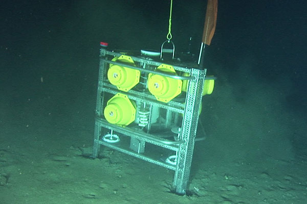
Recovery of Gulf of Mexico deep-sea lander equipped with rotating (monthly) sediment trap that was deployed in the north central Gulf of Mexico (Viosca Knoll region) after the DWH oil spill (from Oct-10 to Sept-11). Photo courtesy of S. Ross, University of North Carolina, Wilmington.
A USGS-led study found a reduction in carbon export to the deep sea up to 18 months after the 2010 Deepwater Horizon oil spill, potentially related to a decrease in surface-ocean primary productivity. Delivery of organic matter from surface waters is crucial to sustaining many ecosystems too deep for sunlight to reach. Most deep-sea corals, for example, feed primarily on surface-derived organic carbon. Nancy Prouty, Pamela Campbell, Amanda Demopoulos and colleagues measured geochemical tracers from monthly sediment-trap samples collected before (Oct '08 to Sept '09) and after the spill (Oct ’10 to Sept ’11). In addition to evidence for reduced primary production, the samples contained low-14C carbon (e.g., petro-carbon), some of which might have come from the spill. The results were released 17 November 2015 in Elsevier’s Estuarine, Coastal and Shelf Science at doi:10.1016/j.ecss.2015.11.008. For more information, contact Nancy Prouty, nprouty@usgs.gov, 831-460-7526.
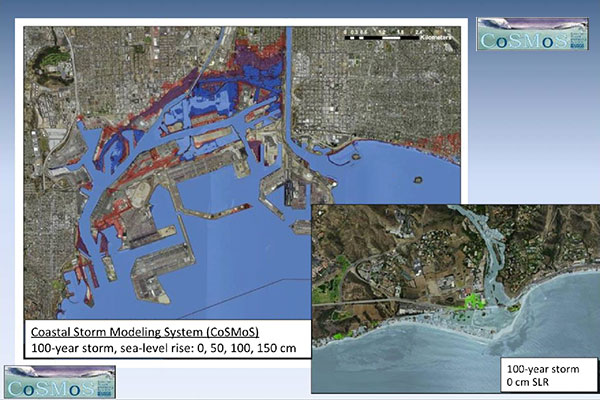
Extreme storm flooding projections from the Coastal Storm Modeling System (CoSMoS), in Los Angeles (left) and Malibu.
Andy O’Neill, an oceanographer and meteorologist with the USGS Pacific Coastal and Marine Science Center, explained what El Niño is and how this year’s El Niño might affect Southern California in a webinar produced by University of Southern California (USC) Sea Grant. Her half-hour presentation opened “El Niño: What to Expect for Southern California,” a professional-development webinar broadcast October 28, 2015 (see other webinars at http://dornsife.usc.edu/uscseagrant/adaptla-webinars/). O’Neill’s clear explanation of the many facets of this complex phenomenon included a description of the Coastal Storm Modeling System (CoSMoS) and its latest extreme-storm flooding projections for Southern California. Many California agencies are eager to use these projections in their El Niño planning.
For more information, contact Andy O’Neill, aoneill@usgs.gov,
831-460-7586.
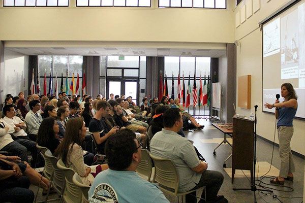 USGS Research Oceanographer Speaks to STEM Students at Community College
Research oceanographer Nancy Prouty spoke to approximately 100 students at the STEM (Science, Technology, Engineering, and Mathematics) Center at Cañada College, a community college in Redwood City, California, on October 14, 2015. As part of the college’s STEM Speaker Series, Prouty described her education and career path, gave a presentation on her deep-sea coral research with the USGS, and offered advice to the STEM students. Her presentation was also open to the public.
For more information, contact Nancy Prouty, nprouty@usgs.gov,
831-460-7526.
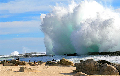
A 2012 photograph shows the impact of a large wave at the south shore of Laysan Island, with endangered Laysan teal in the foreground. Photo by Michele Reynolds. [Larger version]
A new study shows that the combined effect of storm-induced wave-driven flooding and sea level rise on island atolls may be more severe and happen sooner than previous estimates of inundation predicted by passive “bathtub” modeling for low-lying atoll islands, and especially at higher sea levels forecasted for the future due to climate change. More than half a million people live on atolls throughout the Pacific and Indian Oceans, and although the modeling was based on the Northwestern Hawaiian Islands, the results from the study apply to almost all atolls.
Read the entire USGS News Release; and learn more about the study, published in Nature's Scientific Reports.
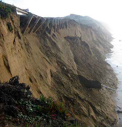
Bluff erosion during the 2009–10 El Niño undermined the Great Highway guardrail at the southern end of Ocean Beach, San Francisco, California. The shoreline eroded, on average, 55 meters that winter, leading to lane closures on the highway and an emergency $5-million revetment along the base of this bluff. Photo taken by Jeff Hansen, USGS, 20 January 2010.
The projected upsurge of severe El Niño and La Niña events will cause an increase in storms leading to extreme coastal flooding and erosion in populated regions across the Pacific Ocean, according to new research by USGS scientists at the Pacific Coastal and Marine Science Center and their collaborators at institutions in Australia, New Zealand, Canada, Italy, Japan, and the United States. These results are independent of projected sea-level rise, which alone could displace up to 187 million people worldwide by the end of the 21st century. Nature Geoscience published the findings on September 21, 2015.
For more information:
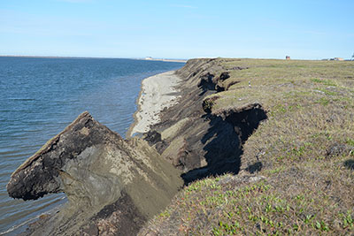
Eroding bluffs on Barter Island, north coast of Alaska. Photograph by Ben Jones, USGS Alaska Science Center. [Larger version]
In a new study published July 2015, scientists from the U.S. Geological Survey (USGS) found that the remote northern Alaska coast has some of the highest shoreline-erosion rates in the nation. Analyzing more than half a century of shoreline-change data, scientists discovered that the pattern is extremely variable, with most of the coast retreating at rates of more than 1 meter per year.
"This report provides invaluable objective data to help Native communities, scientists, and land managers understand natural changes and human impacts on the Alaskan coast," said Ann Gibbs, USGS geologist and lead author of the new report.
Read the entire Sound Waves Newsletter article.
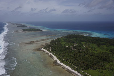
Aerial photograph of Kwajalein Atoll in the Republic of the Marshall Islands, showing its low-lying islands and coral reefs. The line of breaking waves on the left marks the reef crest, where much of the waves' energy is dissipated. Additional energy is lost through friction as the water flows shoreward over the rough surface of the healthy reef flat. USGS photograph taken May 2015 by Tom Reiss. [Larger version]
Climate change may reduce the ability of coral reefs to protect tropical islands against wave attack, erosion, and salinization of the drinking-water resources that help to sustain life on those islands. A new paper by researchers from the Dutch independent institute for applied research Deltares and the USGS gives guidance to coastal managers to assess how climate change will affect a coral reef’s ability to mitigate coastal hazards.
In order to prevent or mitigate these impacts, coastal managers need know to what extent their reef system may lose its protective function so that they can take action. The new paper, titled "The influence of coral reefs and climate change on wave-driven flooding of tropical coastlines," gives guidance on a local reef's sensitivity to change. It was published 4 August 2015 in Geophysical Research Letters, a journal of the American Geophysical Union.
Read the entire Sound Waves Newsletter article.
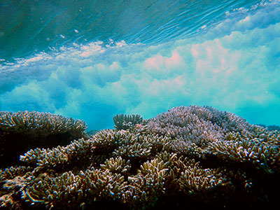
Research geologist Curt Storlazzi took this underwater photograph of a wave breaking over a coral reef on May 5, 2014, on Kwajalein Atoll in the Republic of the Marshall Islands. A healthy coral reef helps prevent erosion and flooding by reducing the energy of waves before they reach the shore. Storlazzi studies factors that affect coral reef health, including sea-level rise and projected impacts of climate change [Larger version]
An underwater coral photograph taken by USGS research geologist Curt Storlazzi in Kwajalein Atoll, Republic of the Marshall Islands, was chosen by Popular Photography magazine as its Photo of the Day for August 3, 2015. The photo shows a wave breaking over a section of coral reef. A healthy coral reef can help prevent island erosion and flooding by reducing the energy of waves before they hit the shoreline. Storlazzi, of the Pacific Coastal and Marine Science Center in Santa Cruz, California, took the photo for a project he leads titled "Impact of Sea-Level Rise and Climate Change on Pacific Ocean Atolls.”
Read the entire Sound Waves Newsletter article.
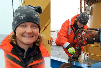
Above left, Jenny White on the U.S. Coast Guard Cutter (USCGC) Healy in August 2010, where she supported USGS-led sediment sampling in the Arctic Ocean as part of the U.S. Extended Continental Shelf Project. Above right, Jenny rigs a gravity corer on the USCGC Healy, August 11, 2010. USGS photographs by Helen Gibbons.
Jenny White is the new Marine Operations Superintendent for the Marine Facility (MarFac) at the USGS Pacific Coastal and Marine Science Center in Santa Cruz, California. She takes over from George Tate, who has retired after a long history with the USGS, including leading MarFac since 2011.
“Jenny brings a breadth of experience, vision, enthusiasm, and excellent communication skills to the MarFac lead position,” said Center Director Robert Rosenbauer.
Read the entire Sound Waves Newsletter article.
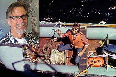
George brandishes a grappling hook in a boat in Cook Inlet, Alaska, 1978. The driver (not shown) and George are about to motor away from the research vessel Sea Sounder to drag for a Geoprobe that had not deployed its recovery float and line. The work was part of a bottom boundary layer/sediment-transport study. Inset: George in 2008; photo by Laura Zink Torresan.
After many years of service to the USGS, most recently as the chief of the Marine Facility (MarFac) at the USGS Pacific Coastal and Marine Science Center in Santa Cruz, California, geologist and engineer George Tate is retiring. His plans for the future include “chasing waves and trout, sailing fast, and exploring the backcountry and backwaters of places revisited and those not yet traveled.” Marine technician Jenny White has taken over his position as MarFac chief.
Center Director Robert Rosenbauer said, “I will miss working with George, who has so capably held this position and advised me so well over the years.”
Read the entire Sound Waves Newsletter article.
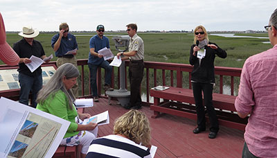
USGS research oceanographer Li Erikson (second from right) tells Congressional staffers about flooding threats posed to coastal communities by sea-level rise and climate-change-driven storms.
USGS research oceanographer Li Erikson explained to Congressional staffers how the USGS Coastal Storms Modeling System (CoSMoS) can help managers assess potential flooding threats to coastal communities and ecosystems caused by sea-level rise and climate-change-driven storms. Erikson is lead modeler of the CoSMoS project led by USGS research geologist Patrick Barnard. Her presentation was part of the USGS Congressional Field Trip to California run by the USGS Office of Communications and Publishing from August 30–September 4, 2015. Erikson spoke at an estuary near Seal Beach in southern California, one of the areas vulnerable to flooding in the case of a strong storm combined with 21st-century sea-level rise. She also described USGS climate-change studies focused on Alaska and low-latitude Pacific Islands. For more information, contact Li Erikson, lerikson@usgs.gov, 831-460-7563.
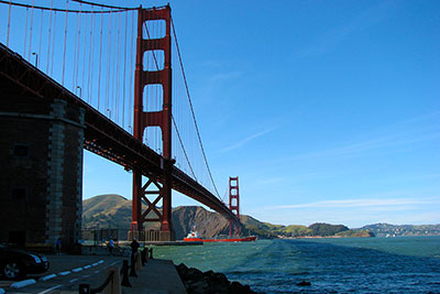
Golden Gate Bridge in San Francisco, looking up from Fort Point. Photo by Laura Zink Torresan, USGS
USGS research geophysicist Eric Geist was interviewed by Johanna Varner, a reporter with KQED News, after the release of the movie “San Andreas,” in which a 500-foot tsunami washes over California’s Golden Gate Bridge and into San Francisco Bay. Varner quoted Geist in her story, “What Would Really Happen If A Tsunami Hit San Francisco?” Geist noted that the region’s faults are not the type that produces large tsunamis, and he described some historical effects of tsunamis from more distant faults. KQED is a public media outlet in San Francisco; the story is part of its series “Bay Curious,” which answers questions from listeners and viewers.
Learn more about USGS tsunami studies. For additional information, contact Eric Geist, egeist@usgs.gov, 650-329-5457.
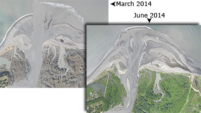
The mouth of the Elwha River in Washington. Top left aerial photograph was taken in March 2014 as the dam removal project sent sediment its way. Bottom right was taken in June 2014, showing the extent of the changes. Photographs by Andy Ritchie, National Park Service. [Larger version]
Research geologist Jonathan Warrick of the Pacific Coastal and Marine Science Center was quoted extensively in a New York Times article about the effects of removing two large dams from the Elwha River in Washington State: “When Dams Come Down, Salmon and Sand Can Prosper.” The article was posted August 10, 2015. Article author Cornelia Dean interviewed Warrick on July 10 to learn how massive amounts of sediment released during dam removal have altered the coast at the Elwha’s mouth in the Strait of Juan de Fuca. The interview was prompted by a USGS news release issued in February about published reports. Learn more about USGS science in support of the Elwha River Restoration Project.
For additional information, contact Jonathan Warrick, jwarrick@usgs.gov, 831-460-7569.
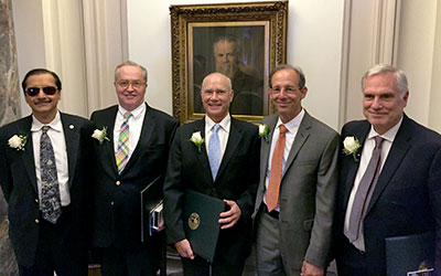
Five of twelve USGS employees who received the Department of the Interior’s highest honor—the Distinguished Service Award: (left to right) Rama Kotra, Peter Lyttle, James Hein, David Oppenheimer, and David Lockner. Behind them is a portrait of the first director of the USGS, John Wesley Powell.
When USGS senior scientist James R. Hein joined the USGS in the early 1970s, he began a long career of marine research, with a particular emphasis on deep-ocean mineral deposits. On May 7, 2015, “in recognition of his outstanding contributions to the U.S. Geological Survey in the fields of coastal and marine geology and geochemistry,” Hein received the U.S. Department of the Interior (DOI) Distinguished Service Award—the highest award that can be granted to a career employee within the DOI.
Read the entire Sound Waves article, which includes the award citation signed by Secretary of the Interior Sally Jewell.
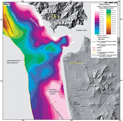
Map of sediment thickness in state waters (from shoreline out 3 nautical miles) offshore of San Francisco. From “California State Waters Map Series—Offshore of San Francisco, California.”
Three new sets of maps detail the offshore bathymetry, habitats, geology, and submarine environment of the seafloor off the coast of San Francisco, Drakes Bay, and Tomales Point. Critical for resource managers, the maps are part of the California Seafloor Mapping Program series of maps published by the USGS with support from the California Ocean Protection Council (OPC), the National Oceanic and Atmospheric Administration (NOAA), and 15 other state and federal partners. The maps are designed to be used by a large stakeholder community and the public to manage and understand California’s vast and valuable marine resources.
Read the entire Sound Waves article.
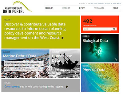
Slide from Todd Hallenbeck (West Coast Governor’s Alliance on Ocean Health), showing the home page of the West Coast Ocean Data Portal website.
The fifth meeting of the Monterey Bay Marine GIS User Group was held on April 16, 2015, at the USGS Pacific Coastal and Marine Science Center in Santa Cruz, California. A GIS (geographic information system) is a computer-based system for storing, manipulating, analyzing, and managing all types of geographically referenced information. The goals of this user group are to foster collaboration among academic institutions, the private sector, government agencies, and non-governmental organizations (NGOs) in the Monterey Bay marine GIS science community; to facilitate hands-on GIS training; and to increase awareness of marine spatial data sets within the broader GIS science community in the Monterey Bay area.
Read the entire Sound Waves article.
Tens of thousands of people along the U.S. Pacific Northwest coastline may not have enough time to evacuate low-lying areas before tsunami waves arrive, according to a new publication by researchers at the USGS, University of Colorado Boulder, and California State University, Sacramento.
Read the entire Sound Waves article.
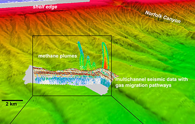
Three-dimensional perspective view of deepwater seeps south of Norfolk Canyon on the northern U.S. Atlantic margin. See more detail in the Sound Waves article.
Scientists from the U.S. Geological Survey (USGS) Gas Hydrates Project surveyed methane seeps and plumes on the northern part of the U.S. Atlantic margin aboard the research vessel (R/V) Endeavor in April 2015. The researchers collected high-resolution seismic data (cross-sectional views of sediment layers and other features beneath the seafloor) along ship tracks totaling nearly 580 kilometers (360 miles), in addition to continuous imagery of methane plumes in the water column above seafloor cold seeps. They also measured the flux of methane and carbon dioxide (CO2) from the ocean to the atmosphere.
Read the entire Sound Waves article.

Aerial photograph of Kwajalein Atoll showing its low-lying islands and coral reefs. Photograph by Tom Reiss. [Larger version]
USGS Newsroom—Coral reefs, under pressure from climate change and direct human activity, may have a reduced ability to protect tropical islands against wave attack, erosion and salinization of drinking water resources, which help to sustain life on those islands. A new paper by researchers from the Dutch independent institute for applied research Deltares and the U.S. Geological Survey gives guidance to coastal managers to assess how climate change will affect a coral reef’s ability to mitigate coastal hazards.
The article is titled, “The influence of coral reefs and climate change on wave-driven flooding of tropical coastlines,” and is available online at doi:10.1002/2015GL064861
Read the entire USGS Newsroom article.
Learn more about coral reefs and climate change on our USGS Coral Reefs Web Site.
Read more about our research on the impacts on low-lying areas of tropical Pacific islands.
Read more about our research on The Impact of Sea-Level Rise and Climate Change on Pacific Ocean Atolls.
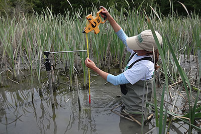
USGS research ecologist Melissa Foley, measuring sediment accumulation in the Elwha estuary complex using a surface elevation table (SET). Photograph by Michelle Briggs, Lower Elwha Klallam Tribe.
Removal of two dams on Washington's Elwha River mobilized decades worth of the river's annual sediment load from the reservoirs, most of it traveling to the coast where the river meets salt water. A recently published paper describes dramatic changes to water quality and hydrology of the Elwha River estuary during dam removal. During the 3 years of dam removal, large accumulations of sediment at the river mouth greatly reduced tidal influence in the estuary, changing the historical estuary conditions from brackish and tidally influenced to perpetually freshwater and influenced by river discharge. Whether these changes have changed the function of the estuary, an important nursery area for juvenile salmon, is the topic of ongoing studies. Scientists from USGS Pacific Coastal and Marine Science Center, USGS Western Fisheries Research Center, National Park Service, and the Lower Elwha Klallam Tribe co-authored the paper that recently became available as an "online first" document at the journal Limnology and Oceanography:
Foley, M.M., J.J. Duda, M.M. Beirne, R. Paradis, A. Ritchie, and J.A. Warrick. 2015. Rapid water quality changes in the Elwha River estuary complex during dam removal. Limnology and Oceanography. doi:10.1002/lno.10129
For more information, please contact Melissa Foley, mfoley@usgs.gov, 831-460-7564.
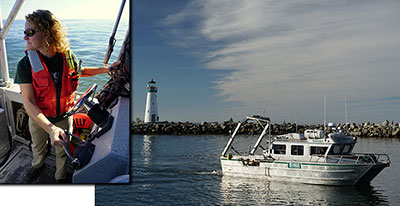
Jenny White driving the USGS research vessel Parke Snavely near the entrance to the Santa Cruz Harbor in Santa Cruz, California. Inset: Driving from the rear of the vessel. [Larger version]
Jenny White has been selected as the new Marine Operations Superintendent for the Marine Facility (MarFac) at the USGS Pacific Coastal and Marine Science Center (PCMSC) in Santa Cruz, California. “Jenny brings a breadth of experience, vision, enthusiasm, and excellent communication skills to the Marfac lead position,” said Center Director Robert Rosenbauer. Her prior science-support experience includes serving as senior representative for Raytheon Polar Services on Antarctic icebreakers. As a USGS employee, she has been a vessel master for the USGS research vessel Parke Snavely and has supported USGS scientists in the acquisition of seismic and mapping data as well as the deployment of oceanographic and sampling gear. White takes over from George Tate, who is retiring after a long history with PCMSC, including leading MarFac since 2011.
For more information, please contact Robert Rosenbauer, brosenbauer@usgs.gov, 831-460-7401.

Eroding bluffs on Barter Island, north coast of Alaska. Photograph by Ben Jones, USGS Alaska Science Center. [Larger version]
A USGS Open-File Report (doi:10.3133/ofr20151048) published July 1, 2015, reports that the remote northern Alaska coast has some of the highest shoreline-erosion rates in the nation. Analyzing more than half a century of shoreline-change data along more than 1,600 kilometers of coast—from the U.S.-Canada border to Icy Cape—scientists found the pattern highly variable, with most of the coast retreating at an average rate of 1.4 meter/year. Extreme erosion in small areas exceeds 18.6 meter/year. “Coastal erosion along the Arctic coast of Alaska is threatening Native Alaskan villages, sensitive ecosystems, energy- and defense-related infrastructure, and large tracts of Native Alaskan, State, and Federally managed land,” said USGS Acting Director Suzette Kimball. The comprehensive assessment will help guide managed response to sea-level rise and storm impacts.
For more information, view the news release or contact Ann Gibbs, agibbs@usgs.gov, 831-460-7540.

USGS oceanographer Nancy Prouty shows deep-sea corals to 2nd graders in east Menlo Park, California, who were fascinated by exciting work they can do if they study hard.
On May 19, 2015, USGS oceanographer Nancy Prouty gave a presentation at Belle Haven elementary school, which serves a largely Hispanic community in east Menlo Park, California. She showed 2nd-graders examples of deep-sea corals and explained how scientists collect and study them. The children, who have been learning about marine animals, were fascinated by the coral and by visions of exciting work they can do if they study hard. Prouty’s research on deep-sea corals was also recently featured in an article in Swimmer (http://www.usmsswimmer.com/), a magazine for the U.S. Masters Swimmers program, of which she is a member.
For more information, contact Nancy Prouty, nprouty@usgs.gov, 831-460-7526.
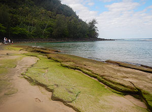
Bright green algae on a beach on the north shore of Kauaʻi. Such algae growth often indicates that groundwater is seeping into the ocean and bringing with it excess nutrients, such as fertilizer from nearby cultivated areas. [Larger version]
USGS oceanographer Peter Swarzenski was interviewed May 21, 2015, by Brittany Lyte, environmental reporter for The Garden Island newspaper on Kauaʻi, Hawaiʻi. Lyte wanted to learn more about a new project Swarzenski is leading to investigate factors that may be affecting a coral disease called “black band disease” on Kauaʻi’s north shore. The project will examine the relationship between the coral disease and groundwater inputs, as well as other environmental factors, such as ocean tides and water temperature. The resulting article was published Sunday, May 24.
For more information, contact Peter Swarzenski, pswarzen@usgs.gov, 831-460-7529.
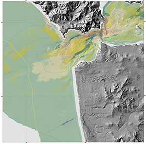
“Seafloor character” map of the San Francisco Region. [high resolution image, 1 MB]
Released: 5/21/2015 2:00:00 PM
Three new sets of maps detail the offshore bathymetry, habitats, geology and submarine environment of the seafloor off the coast of San Francisco, Drakes Bay, and Tomales Point. Critical for resource managers, the maps are part of the California Seafloor Mapping Program, a series of maps published by the U.S. Geological Survey with support from the California Ocean Protection Council, NOAA, and 15 other state and federal partners. The maps are designed to be used by a large stakeholder community and the public to manage and understand California’s vast and valuable marine resources.
The new maps and some of their implications were featured in a Wired magazine article, “New Maps Reveal California’s Sensational Seafloor Geography,” on May 22.
For more information, visit the USGS Newsroom page, or contact Sam Johnson, sjohnson@usgs.gov, 831-460-7546.
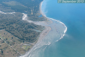
Aerial photograph of the Elwha River mouth on the 27th of September, 2013, during dam removal, showing the expansion of the river mouth delta by sediment deposition. Photo courtesy of Neal and Linda Chism, volunteers with LightHawk.
The effects of dam removal are better known as a result of several new studies released in February 2015 by government, tribal, and university researchers. The scientists worked together to examine and report the effects of removing two large dams from the Elwha River in Washington State, the largest dam-removal project in U.S. history. New findings suggest that dam removal can change landscape features of river and coasts, affecting ecosystems downstream of former dam sites.
“These studies not only give us a better understanding of the effects of dam removal, but show the importance of collaborative science across disciplines and institutions,” said Suzette Kimball, Acting Director of the U.S. Geological Survey (USGS).
Read the entire article in the Sound Waves newsletter.
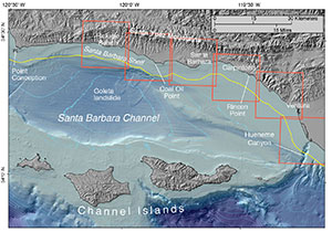
Santa Barbara Channel region, showing locations of six California Seafloor Mapping Program map sets (rectangles) and the outer boundary of California’s State Waters (squiggly line following the coastline).
The California Seafloor Mapping Program (CSMP) has released its latest set of maps and data, “California State Waters Map Series—Offshore of Refugio Beach, California,” U.S. Geological Survey Scientific Investigations Map 3319. The “Offshore of Refugio Beach” maps lie within the western Santa Barbara Channel in southern California, and their publication marks a CSMP milestone: the first phase of map and geospatial data publications, comprising six USGS Scientific Investigations Maps and associated data files centered on the Santa Barbara Channel, is now complete. The maps are part of an ambitious collaborative effort to develop comprehensive bathymetric (seafloor depth), habitat, and geologic maps for all of California’s State Waters, which extend from the shoreline to 5.56 kilometers (3 nautical miles) offshore. These State Waters maps provide many types of information with a large range of applications.
Read the entire article in the Sound Waves newsletter.
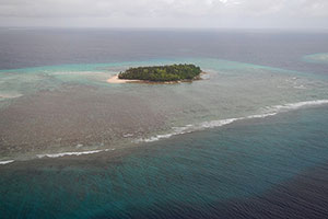
Aerial photograph of waves breaking on the fringing reef off Ennuebing Island, Kwajalein Atoll, Republic of the Marshall Islands.
According to a report released in January 2015 by the U.S. Geological Survey (USGS), climate changes during the 21st century are expected to alter the highest waves and strongest winds across U.S. and U.S.-affiliated Pacific islands.
“With little to no publicly available historical wind and wave data for most of the U.S.-affiliated Pacific islands, and no future projections of waves and winds for different climate scenarios, there was a great science and management need to understand how waves and wind might change in future climates,” said Curt Storlazzi, USGS oceanographer and lead author of the study.
Read the entire article in the Sound Waves newsletter.
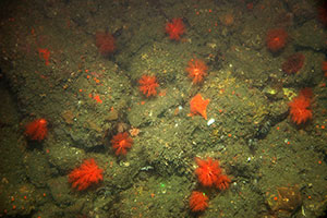
Boulders and biota off San Gregorio, California, in water approximately 30 meters (100 feet) deep. Organisms include bat stars, small sea anemones, strawberry anemone, cup corals, and frilly sea cucumbers. Two green laser dots are 15 centimeters (6 inches) apart; lefthand dot is at bottom center of photograph, righthand dot is on upper right edge of lowermost frilly sea cucumber.
Thousands of photographs and videos of the seafloor and coastline—most areas never seen before—are now easily accessible online. This imagery, available through the USGS Coastal and Marine Geology Video and Photograph Portal, will help coastal managers to make important decisions, ranging from protecting habitats to understanding hazards and managing land use.
“The USGS has been dedicated to developing a system that allows for convenient communication internally as well as to outside collaborators and the public. We want a wide range of users to be able to access our abundance of coastal and seafloor imagery,” said USGS geographer Nadine Golden, lead principal investigator for the USGS portal. “The portal makes it easy for users to discover, obtain, and disseminate information.”
Read the entire article in the Sound Waves newsletter.
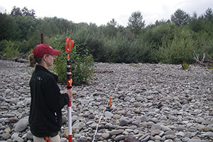
Before dam removal, Amy East (then Amy Draut) surveys along the Elwha River in March 2007. USGS photograph by Joshua Logan.
The largest dam removal in U.S. history was the subject of a public lecture by USGS research geologist Amy East on February 26, 2015, at the USGS campus in Menlo Park, California. East described changes to the landscape caused by the removal of two large dams—the 32-meter-tall Elwha Dam and the 64-meter-tall Glines Canyon Dam—from the Elwha River in Washington State. This was the largest dam removal ever undertaken, both in terms of the dams’ heights and in terms of how much sediment had accumulated behind them.
Read the entire article in the Sound Waves newsletter.
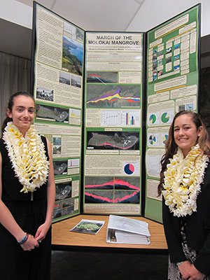
Hawaiʻi State Science and Engineering Fair award winners Lily (left) and Sarah (right) Jenkins, of Molokaʻi High School. Photograph by Mahealani Bambico; used with permission. [Larger version]
Susan Cochran of PCMSC provided mentoring help to two sisters on Molokaʻi, Hawaiʻi, for a science-fair project that won top awards at the Hawaiʻi State Science and Engineering Fair and earned them a spot at the Intel International Science and Engineering Fair (ISEF) in Pittsburgh, Pennsylvania, May 2015. Molokaʻi High School students Lily and Sarah Jenkins researched the destructive effects of mangroves, an introduced species that could threaten coral reefs on Molokaʻi’s south shore, where USGS has conducted extensive studies. Their “March of the Molokai Mangrove” project included geographic information system (GIS) analysis of aerial imagery, historical maps, and coastal surveys to measure how fast mangroves are migrating seaward. Cochran supplied the students with published aerial and seafloor imagery, bathymetric and topographic data, directions to additional materials, and GIS tips.
Lily and Sarah went on to win First Award ($3,000) in the category Earth and Environmental Sciences for their project, at the Intel ISEF in Pittsburg!
For more information, contact Susan Cochran, scochran@usgs.gov, 831-460-7545.

Aerial photograph of waves breaking on the fringing reef off Ennuebing Island, Kwajalein Atoll, Republic of the Marshall Islands.
Democratic staff from the U.S. House of Representatives’ Committee on Natural Resources requested a briefing in March on how waves and winds around U.S. and U.S.-affiliated Pacific Islands will change in the 21st century and how these changes will affect infrastructure, renewable energy, ecosystems, shipping, and recreation. The request was prompted by a recent USGS report, “Future Wave and Wind Projections…”, that details how waves and winds will change under different climate-change scenarios. The report’s lead author, USGS research geologist Curt Storlazzi, gave the briefing by telephone on March 12, 2015, from the USGS Pacific Coastal and Marine Science Center in Santa Cruz, California. For more information, contact Curt Storlazzi, cstorlazzi@usgs.gov, 831-460-7521.
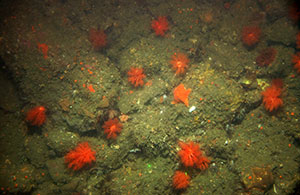
Rounded to subrounded boulders and rugose rock (water depth, 30 m). Abiotic complexity is high, biotic complexity is absent, and biocover is high. Biocover includes bat star; sea anemone; strawberry anemone, cup corals; and frilly sea cucumbers. [Larger version]
USGS geographer Nadine Golden was interviewed on March 23, 2015, by Santa Cruz Sentinel reporter Samantha Clark about the newly released USGS Coastal and Marine Geology Video and Photograph Portal (http://www.usgs.gov/newsroom/article.asp?ID=4156). Clark’s article was published online on March 23 and on the front page of the print edition on March 24. The portal contains thousands of photographs and videos of seabed and coastline along the nation’s Atlantic, Gulf, and Pacific shores. It allows anyone to explore never-before-seen areas; it helps coastal managers and scientists study seafloor composition and habitats and better understand coastal hazards. Puget Sound, Hawaii, and the Arctic will eventually be represented. Additional video and photographs, including archived imagery, will be added as they become available. For more information, visit the portal (https://doi.org/10.5066/F7JH3J7N) or contact Nadine Golden, ngolden@usgs.gov, 831-460-7530.
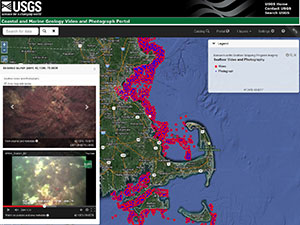 Newly Released Database of Coastal and Seafloor Imagery Draws Media Attention
LA Times science writer Sean Greene interviewed USGS geographer Nadine Golden on March 18, 2015, about the USGS Coastal and Marine Geology Video and Photograph Portal released that day (https://doi.org/10.5066/F7JH3J7N). The portal makes thousands of photos and videos of the seafloor and coastline (most areas never seen before) available and easily accessible online. This database is the largest of its kind, providing detailed and fine-scale representations of the coast. New video and photographs will be added as they are collected, and archived imagery will also be incorporated over time. The database will help coastal managers to make important decisions, ranging from protecting habitats to understanding hazards and managing land use. Greene’s piece on the portal appeared in the LA Times online Science section (http://touch.latimes.com/#section/621/article/p2p-83101019/) on March 20. For more information, contact Nadine Golden, ngolden@usgs.gov, 831-460-7530.
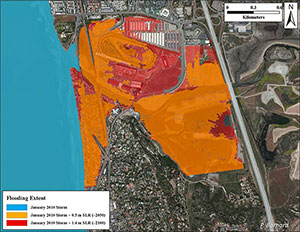
Potential influence of sea-level rise on storm flooding in Del Mar, California (about 20 miles north of San Diego), as calculated by the Coastal Storm Modeling System (CoSMoS). Blue shows the ocean surface during a large storm that struck the area in January 2010, with flooding most evident in the trapezoidal area around the mouth of the San Dieguito River. Orange shows the extent of flooding calculated by CoSMoS for an identical storm after sea-level rise of 0.5 meter (an upper-range projection for the year 2050); red shows additional storm flooding after sea-level rise of 1.4 meters (an upper-range projection for 2100). USGS figure by Patrick Barnard. [Larger version]
On March 5, 2015, USGS coastal geologist Patrick Barnard gave an invited presentation to San Diego area government officials and coastal managers from the Shoreline Preservation Working Group of the San Diego Association of Governments (SANDAG) on climate-change impacts that could affect their planning for the region. Barnard introduced the group to the Coastal Storm Modeling System (CoSMoS), a numerical modeling system developed by the USGS and Netherlands-based research institute Deltares to predict coastal flooding caused by both sea-level rise and storms driven by climate change. CoSMoS was developed to provide coastal planners and emergency responders with critical storm-hazard information that they can use to increase public safety, mitigate physical damage, and more effectively manage and allocate resources within complex coastal settings. For more information, contact Patrick Barnard, pbarnard@usgs.gov, 831-460-7556.
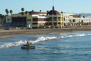
Tim Elfers using an echosounder and GPS receiver mounted on a personal watercraft to survey the seafloor just off the beach near the Santa Cruz Beach Boardwalk. Most of the personal watercraft transects ran perpendicular to the shore, with the transect’s shoreward end as close to the beach as possible to tie into the beach surveys. USGS photograph by Andrew Stevens.
Winter storms modified by future climate changes, including sea-level rise, could mean costly damage to harbors, beaches, and businesses, especially during El Niño years, when atmospheric conditions bring heavy rains to the central California coast. The biggest storms tend to hit later in the year when beaches have already been heavily battered. In a populated area that relies on its coastline for much of its revenue—from people such as surfers, beach goers, sailors, kite surfers, divers, and fisherman—there is a great need to understand how big storms can shape and affect the coast. Perhaps storms will alter an important snowy plover habitat, shift a surf break, or erode natural beach protection for waterfront businesses such as those in Capitola. USGS scientists in Santa Cruz have a rare opportunity to work on these issues close to home and collect data that can affect a range of people and businesses within the Monterey Bay region. Studying these changes now will help researchers create models of future climatic changes that will erode and shape our coasts—a valuable tool for city planners, conservationists, and the tourism industry.
Read more about this new study.
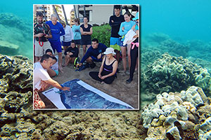
USGS researcher Curt Storlazzi discusses how 150 years of pineapple cultivation has affected the nearshore environment around Kahana, Maui, Hawaiʻi.
During the fall 2014 meeting of the United States Coral Reef Task Force (USCRTF), held in Kāʻanapali, Maui, Hawaiʻi, Curt Storlazzi of the USGS Pacific Coastal and Marine Science Center led a field trip along the west Maui coast to address the science behind the “Past, Present, and Hopefully Future of Maui’s Coral Reefs.” The goal of the field trip was to provide participants with an overview of more than 15 years of integrated scientific investigations by federal, state, academic, and non-governmental organization (NGO) scientists to identify land-based sources of pollution from the Wahikuli and Honokōwai watersheds and document the resulting impact on the adjacent fringing coral reefs.
Read more in the latest edition of Sound Waves.
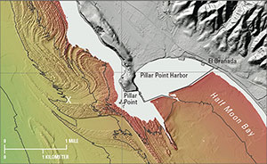
Excerpt from sheet 1 of USGS Open-File Report 2014–1214 produced by the California Seafloor and Coastal Mapping Program. This view shows color shaded-relief bathymetry (seafloor depth) offshore of Half Moon Bay, California, approximately 30 kilometers (20 miles) south of San Francisco.
These workshops gave the large CSCMP team an opportunity to update participants on all that they have accomplished and to receive input that will help them plan future efforts. CSCMP scientists are currently publishing a comprehensive geologic and habitat base-map series for all of California’s State waters (from the shore out 3 nautical miles), and they are seeking feedback on how the program should go forward to best fit diverse scientific and stakeholder needs.
Read more in the latest edition of Sound Waves.
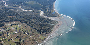
During the first 2 years of dam removal on the Elwha River, approximately 2.4 million cubic meters of sediment was added to the river mouth delta, expanding it seaward by hundreds of meters. Photograph by Neal and Linda Chism, volunteers with LightHawk (http://www.lighthawk.org/). [Larger version]
Dam removal has become an important management and restoration tool. The largest dam-removal project in U.S. history, on the Elwha River in Washington State, is the focus of federal, tribal, and academic scientists collaborating to characterize its effects. Five papers resulting from this work have been published in the journal Geomorphology. They provide detailed observations about changes in the river’s landforms, waters, and coastal zone during the first 2 years of dam removal, when massive amounts of sediment were eroded from the former reservoirs and transported downstream through the river and to the coast. In addition to restoring salmon runs, the dam removal is renewing the downstream movement of sand, gravel, and wood, which are important to river, estuarine, and coastal habitats.
Links to and titles of the new papers on “Large-scale dam removal on the Elwha River, Washington, USA”:
For more information, contact Jonathan Warrick, jwarrick@usgs.gov, 831-460-7569. Also, read the USGS Newsroom Release from February 18, 2015.
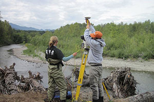
Amy East (left) and Josh Logan used a lidar (light detection and ranging) scanner to collect elevation data along the lower Elwha River, Washington, just before dam removal began in September 2011. These data were compared with data collected after dam removal to document effects on the shape of the river.
Dam removal has become an important management and restoration tool. The largest dam-removal project in U.S. history, on the Elwha River in Washington State, is the focus of federal, tribal, and academic scientists collaborating to characterize its effects. USGS research geologist Amy East presented a public lecture on the Elwha project on February 26, 2015 at the USGS center in Menlo Park, California. She described what happened as the gradual removal of two dams released massive amounts of sediment downstream, causing changes in the river’s landforms, waters, and coastal zone. In addition to restoring salmon runs, the dam removal is affecting river, estuarine, and coastal habitats and providing important lessons for future river-restoration endeavors. For more information, and to watch the video of Amy's talk, visit the USGS Evening Public Lecture Series website: http://online.wr.usgs.gov/calendar/ — or contact Amy East, aeast@usgs.gov, 831-460-7533.
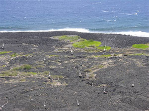
Oblique aerial photograph showing a storm-deposited gravel ridge complex near the shore and an inland field of tsunami-deposited gravel (mostly boulder size) on the southeast coast of the island of Hawaiʻi. Arrows point to individual large boulders. [Larger version]
The editors of Marine Geology sent Bruce Richmond a certificate in January 2015 recognizing his paper “Recent storm and tsunami coarse-clast deposit characteristics, Southeast Hawaii” (Richmond and others, https://doi.org/10.1016/j.margeo.2010.08.001) as one of the journal’s three most-cited papers published in 2011 and cited in 2012-2013. Richmond and USGS colleague Bruce Jaffe were coauthors on a second paper among the three most-cited: “New insights of tsunami hazard from the 2011 Tohoku-oki event” (Kazuhisa Goto and others, https://doi.org/10.1016/j.margeo.2011.10.004). Richmond’s paper resolved a controversy by showing the distinction between coarse-clast deposits formed by storms (mostly ridges) and those formed by tsunamis (mostly fields of isolated clasts). The Goto paper was one of the first to describe deposits from the devastating 2011 Tohoku-oki tsunami in Japan and presented data suggesting that previous estimates of paleotsunamis in the region have been underestimated. For more information, contact Bruce Richmond, brichmond@usgs.gov, 831-460-7531.
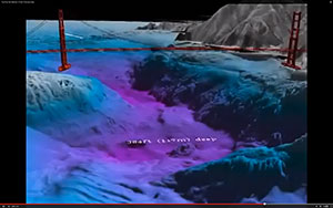
Screenshot from USGS video “Fly Over the Seafloor of San Francisco Bay” at http://gallery.usgs.gov/videos/536.
A USGS video that takes viewers on a virtual “flight” over the floor of San Francisco Bay was featured in January 2015 on the website of Latitude 38, a sailing and marine magazine*. Peter Dartnell of the USGS Pacific Coastal and Marine Science Center created the video from bathymetric data collected by the USGS, NOAA, and California State University, Monterey Bay. Published on the USGS website in 2009 (http://gallery.usgs.gov/videos/536), the video continues to attract and educate viewers. For more information, contact Peter Dartnell, pdartnell@usgs.gov, 831-460-7415.
*The January 2015 issue of Latitude 38 can be found at: http://www.latitude38.com/lectronic/lectronicday.lasso?date=2015-01-12
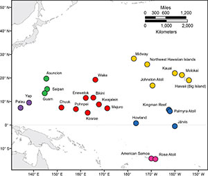
Map showing the locations of the 25 modeled points within the tropical Pacific Ocean used in this study. [Larger version]
According to a new USGS report, climate changes during the 21st century are expected to alter the highest waves and strongest winds across U.S. and U.S.-affiliated islands in the Pacific Ocean. Wave and wind processes drive flooding of coastal land, potentially damaging islands’ infrastructure, fresh-water supplies, and natural resources, and harming federally protected species such as nesting seabirds. Scientists from USGS and the University of California, Santa Cruz, used computer models to look at how climate change will affect wave heights, periods, and directions, and wind speed and direction. Their detailed calculations will be useful for managers developing coastal resilience plans or ecosystem restoration efforts, and for engineers designing future infrastructure. This research was supported by the Pacific Islands Climate Change Cooperative (http://piccc.net/). USGS Open-File Report 2015-1001 is posted at https://doi.org/10.3133/ofr20151001. For more information, contact Curt Storlazzi, cstorlazzi@usgs.gov, 831-460-7521.
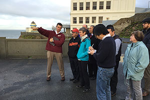
USGS research geologist Patrick Barnard, far left, leads VIPs on a field trip on the cliffs above Ocean Beach, San Francisco. Standing, left to right beside Patrick and in the foreground, are San Francisco Mayor Ed Lee, Secretary of the Interior Sally Jewell, New York Times reporter Ken Chang, and Acting USGS Director Suzette Kimball. Ocean Beach's narrow stretch of coast is exposed to the brunt of the North Pacific Ocean wave climate. Photo courtesy of Tami Heilemann. [Larger version]
Secretary of the Interior Sally Jewell, Acting USGS Director Suzette Kimball, and San Francisco Mayor Ed Lee took part in a coastal climate change field trip led by USGS research geologist Patrick Barnard on December 18, 2014. The field trip visited two beaches along the outer coast of the San Francisco Peninsula that are within the most rapidly eroding stretch of California’s coast. Erosion is currently driven primarily by human influences on sand supply, but projected climate-change impacts, including sea-level rise and extreme storms, will increase the vulnerability of this urbanized coast to beach erosion, cliff failures, and coastal flooding, posing threats to private and public infrastructure, including a state highway and a $1.2-billion wastewater-treatment plant. The USGS has been active in understanding the various coastal processes that control this important section of coastline. For more information, contact Patrick Barnard, pbarnard@usgs.gov, 831-460-7556.
See more photographs from the field trip.
Learn more about the USGS Pacific Coastal and Marine Science Center's climate change studies.