
Woods Hole Science Center
![]() Title |
Introduction |
Setting |
Methods |
Overview |
Interpretation |
Discussion |
Data Catalog |
Acknowledgments |
References |
Figures |
Bottom Photographs |
Sediment Data |
Contacts
Title |
Introduction |
Setting |
Methods |
Overview |
Interpretation |
Discussion |
Data Catalog |
Acknowledgments |
References |
Figures |
Bottom Photographs |
Sediment Data |
Contacts
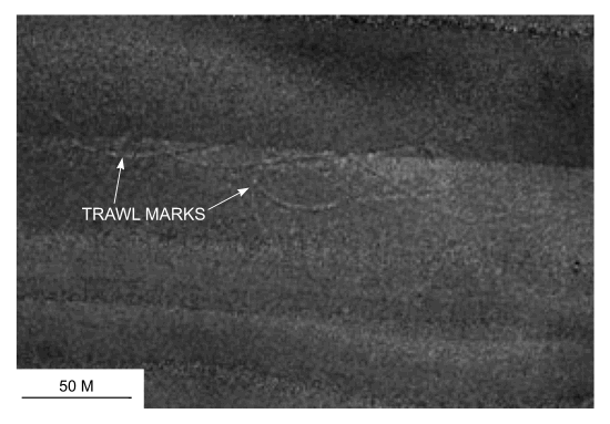 figure 22. "/> figure 22. "/> |
||
Figure 39. Detailed planar view of trawl marks north of Pasque Island from the sidescan sonar mosaic produced during NOAA survey H11076. Location of view is shown in figure 22. | ||


