
Woods Hole Science Center
![]() Title |
Introduction |
Setting |
Methods |
Overview |
Interpretation |
Discussion |
Data Catalog |
Acknowledgments |
References |
Figures |
Bottom Photographs |
Sediment Data |
Contacts
Title |
Introduction |
Setting |
Methods |
Overview |
Interpretation |
Discussion |
Data Catalog |
Acknowledgments |
References |
Figures |
Bottom Photographs |
Sediment Data |
Contacts
 |
||
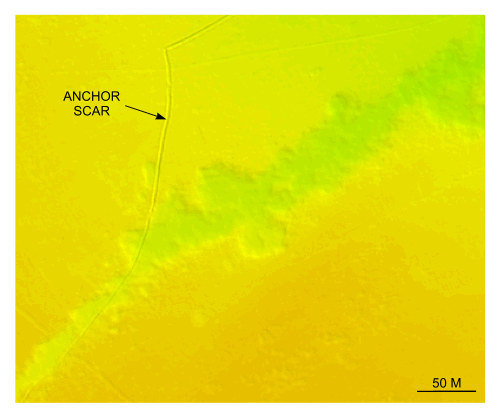
Figure 40. Detailed planar view of an anchor scar and trench north of Nashawena Island from the DTM produced during NOAA survey H11076. Note the change in orientation of the anchor scar probably caused by changing tidal or wind direction and the irregular border of the trench. Location of view is shown in figure 22. | ||


