Woods Hole Science Center

![]() Title |
Introduction |
Setting |
Methods |
Results |
Discussion |
Data Catalog |
Acknowledgments |
References |
Figures |
Contacts
Title |
Introduction |
Setting |
Methods |
Results |
Discussion |
Data Catalog |
Acknowledgments |
References |
Figures |
Contacts
 |
||
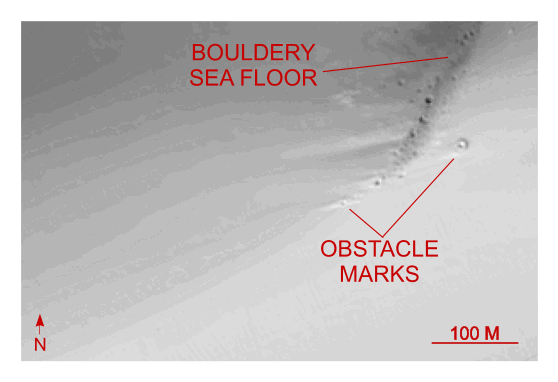
Figure 23. Detailed planar view of multibeam bathymetry from survey H11252 showing the bouldery sea floor along northern edge of this survey area, probably an exposed segment of the offshore extension of the Hammonasset-Ledyard moraine. Note asymmetrical obstacle marks indicating westward transport. Location of detailed view is shown in figure 16. | ||