Woods Hole Science Center

![]() Title |
Introduction |
Setting |
Methods |
Results |
Discussion |
Data Catalog |
Acknowledgments |
References |
Figures |
Contacts
Title |
Introduction |
Setting |
Methods |
Results |
Discussion |
Data Catalog |
Acknowledgments |
References |
Figures |
Contacts
 |
||
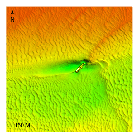
Figure 35. Detailed planar view of multibeam bathymetry from survey H11361 showing the intense scour around wreck of the Lake Hemlock, a converted WW1 cargo ship that sank in 1957, indicating net westward sediment transport. Location of detailed view is shown in figure 15. | ||