
|
About These Web PagesClick on any portion of a poster to view the detail as a web page. 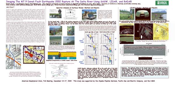
|
| These pages are based on the posters (shown above) presented at the American Geophysical Union, Fall Meeting, December 13-17, 2004, in San Francisco, California. This study was supported by the Alyeska Pipeline Services, Pacific Gas and Electric Company, and the USGS. | |
|
Poster Home Page | Abstract | Study Area | SASW Method & Results | LIDAR & Radar | Summary | About These Web Pages |
|
geotech/denlidarposter/about.html
contact: Robert Kayen
last modified 2018