
Robert Kayen, U S Geological Survey ([email protected]),
Eric Thompson, University of North Carolina at Chapel Hill,
Brian Collins, University of California at Berkeley,
Diane Minasian USGS ([email protected]),
Brad Carkin ([email protected]),
Walter Barnhardt ([email protected])
|
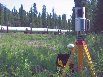
Tripod-mounted ground LIDAR at the Denali Fault crossing of the Trans-Alaska Pipeline |
|
Poster Home Page | Abstract | Study Area | SASW Method & Results | LIDAR & Radar | Summary | About These Web Pages |
|
geotech/denlidarposter/
contact: Robert Kayen
last modified 2018