USGS PCMSC

Imaging The M7.9 Denali Fault Earthquake 2002 Rupture At The Delta River
Using SASW, LIDAR, and RADAR

Index Back to Home Page About These Web Pages Summary LIDAR & Radar SASW Method and Results Study Area Abstract

LIDAR & Radar: Method and Results

Tripod-mounted LIDAR at TAPS. Tripod-mounted LIDAR at Delta River.
GPR operations at Delta River.

We used portable tripod-mounted ground LIDAR and Ground Penetrating RADAR (GPR) to characterize the near surface deformation of the Denali Fault at the Delta River.

LIDAR contour map of fault trace and skypoints. LIDAR contour map.

Ground LIDAR imagery preserves a record of the scarp across the braid-bars of the Delta River. In 2004, the scarp on the Delta River was still well preserved.

LIDAR contour map and surface model.
GPR record showing fault scarp.
LIDAR topographic correlation data for GPR.

LIDAR Topographic correction data for GPR

Ground Penetrating Radar Results:

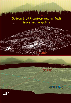
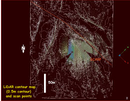
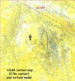
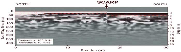
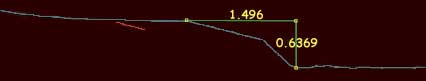
We had mixed success using GPR on the Delta River. Penetration of the braided river deposits, gravelly-sand, was excellent, providing imagery to depths of 15-25 meters. At the fault scarp, dragged beds are clearly observable on the down-dropped side. Normally, we look for discontinuous horizons in GPR data to measure recent offset on a fault. Here, the complexity and chaotic nature of the braid bar sediment partly masked the reflection returns associated with sediment deformation at the fault break. We used the surface model from the LIDAR to make topographic corrections to our GPR imagery.

Poster Home Page | Abstract | Study Area | SASW Method & Results | LIDAR & Radar | Summary | About These Web Pages
Geotech Home Page

geotech/denlidarposter/lidar.html
contact: Robert Kayen
last modified 2018