
The 26 December 2004 Indian Ocean Tsunami: Initial Findings from Sumatra
Damage to Structures
Being just landward of the subduction zone where the tsunami-generating earthquake occurred, northwestern Sumatra was struck by a "near field" tsunami. In contrast, areas across the ocean from the earthquake epicenter, such as Sri Lanka, were struck by "far field" tsunamis. The rapid arrival of the tsunami in near-field locations—just 15 to 20 minutes in Banda Aceh—means that a tsunami early-warning system, now in the planning stages for the Indian Ocean, should be accompanied by tsunami education and long-term emergency and land-use planning efforts for the most effective mitigation of tsunami hazards.
Because the tsunami washed out many roads and bridges, the scientists had to hike long distances to reach some field areas, and on several occasions used makeshift rafts constructed from barrels and boards to cross rivers. Despite such complications, they were able to collect much data, which will be used to improve both the scientific understanding of tsunamis and the computer models used to predict tsunami effects.
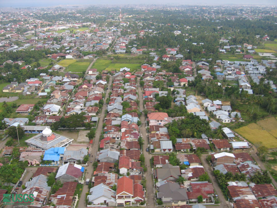 Homes in Banda Aceh far inland experienced minor flooding from the tsunami. [larger image] |
 Homes on the coast were completely obliterated by the tsunami. Photo taken in Banda Aceh [larger image] |
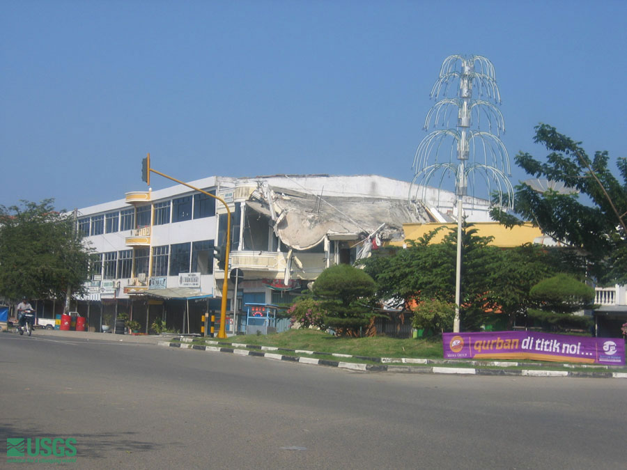 Earthquake damage was minimal. Photo taken in Banda Aceh [larger image] |
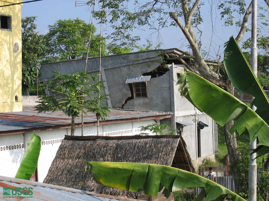 Earthquake damage was minimal. Photo taken in Banda Aceh [larger image] |
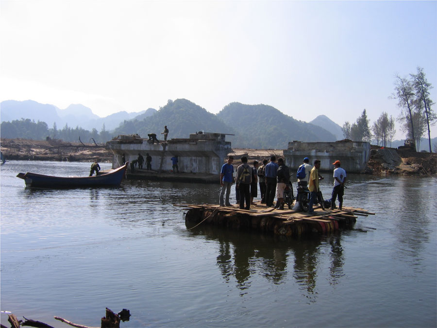 Makeshift rafts were constructed to take locals across rivers where bridges were taken out by tsunami. [larger image] |
 Makeshift rafts were constructed to take locals across rivers where bridges were taken out by tsunami. Some rafts were better than others. [larger image] |
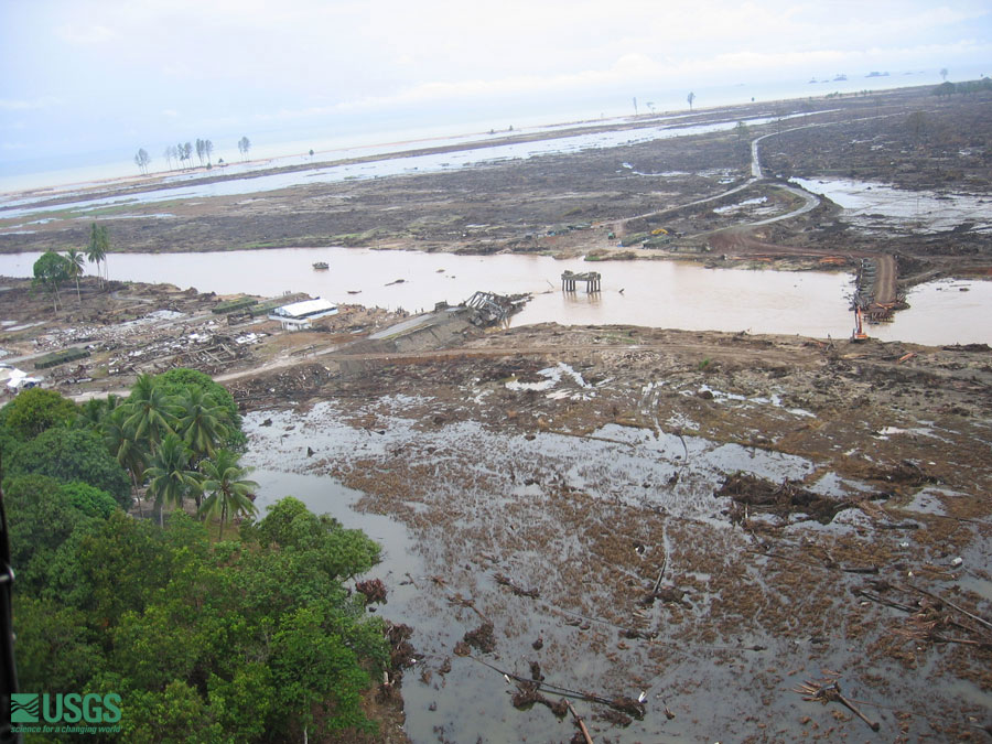 Near the remnants of a bridge destroyed by the tsunami in Krueng Sabe, construction of a new bridge is nearly complete. Photo was taken from helicopter on 28 January 2005. [larger version] |
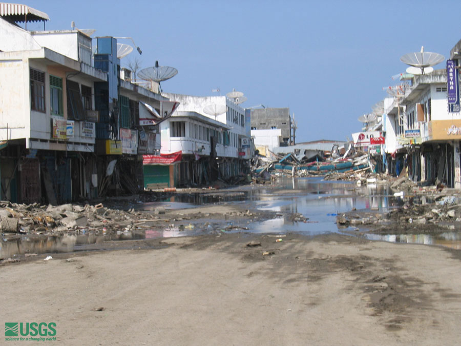 approaching tsunami-affected section of Banda Aceh [larger version] |
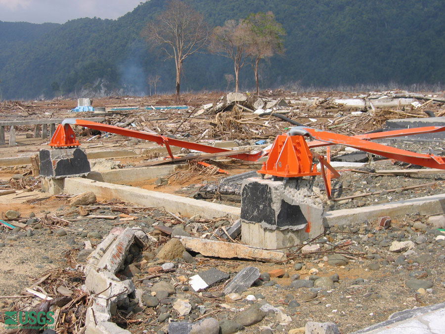
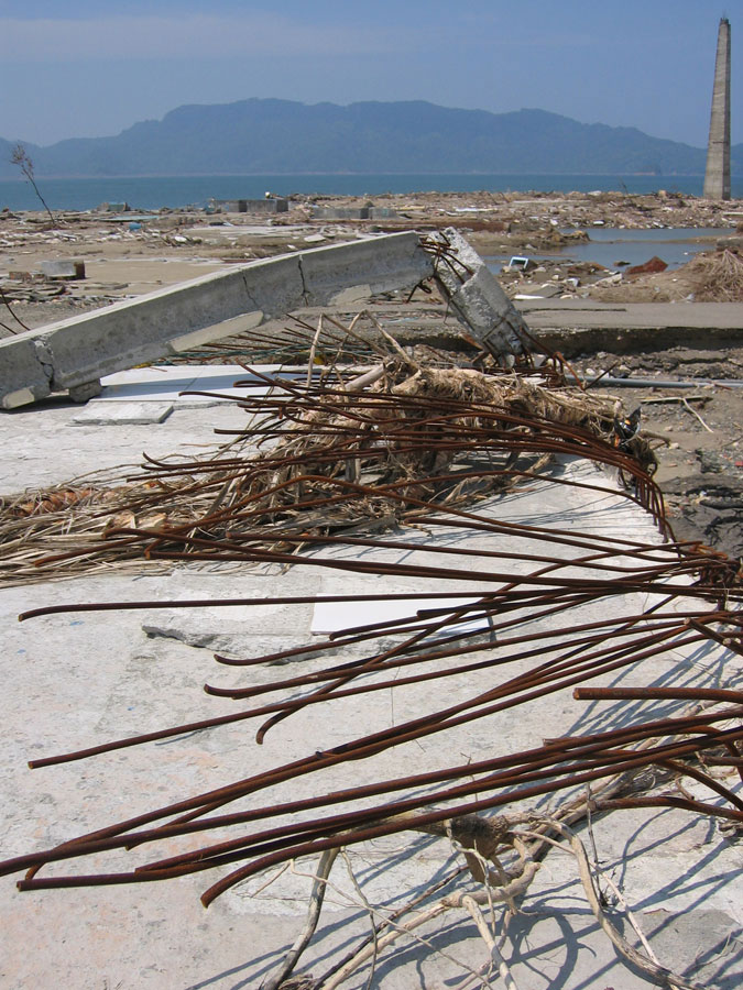 steel reinforcement bent as tsunami removed building [larger version] |
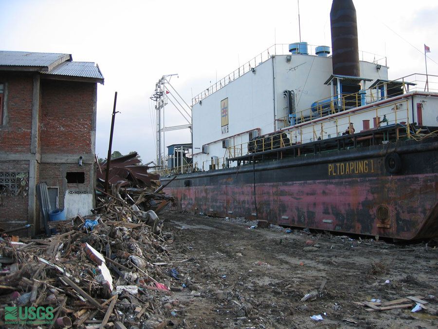 large barge carried inland 3 km by tsunami [larger version] |
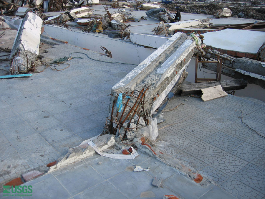 steel-reinforced support bent by tsunami [larger version] |
 steel beams of a cell tower bent over by the force of the tsunami [larger version] |
 Tsunami Sand Deposits
 |
 |
 |
 |