
The 26 December 2004 Indian Ocean Tsunami: Initial Findings from Sumatra
Sumatra Tsunami Survey and Methods
The team collected information about:
- wave heights at the beach and inland,
- inundation distance (how far inland the water reached),
- runup elevation (the water's height relative to mean sea level at its farthest reach inland),
- flow directions,
- erosion,
- sediment deposition, and
- coastal subsidence.
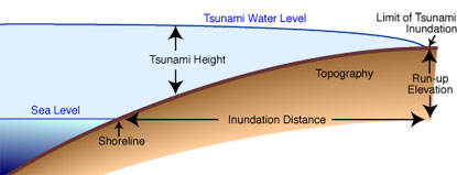
Some of the tsunami characteristics typically measured by survey teams (see Initial Findings on Tsunami Sand Deposits, Damage, and Inundation in Sri Lanka).
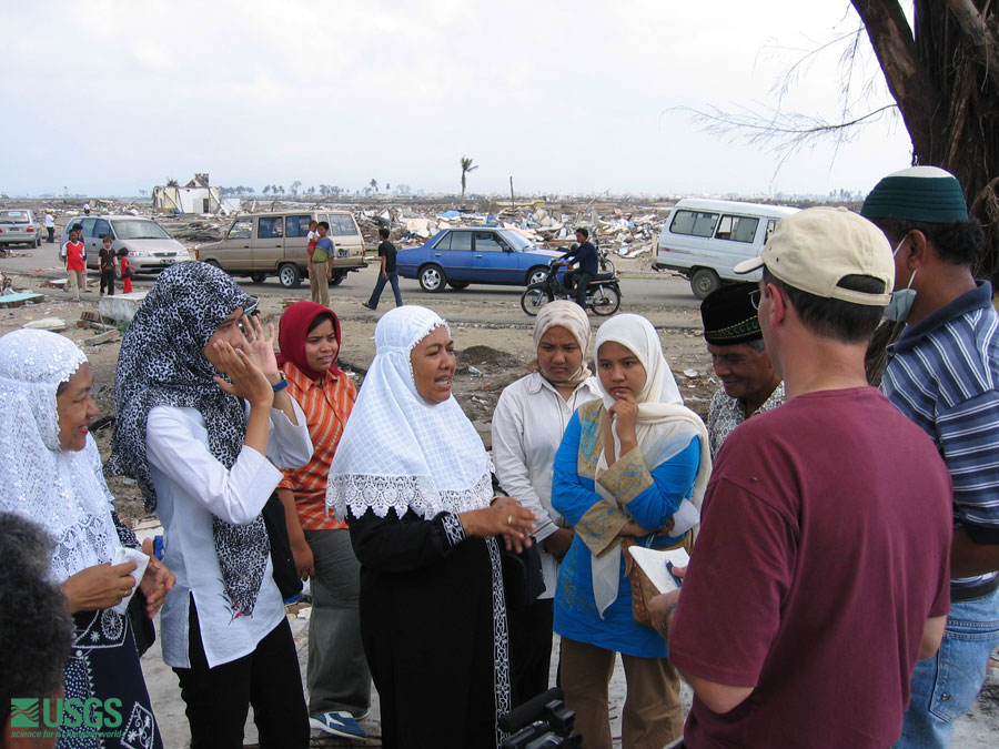
The team gathered some of its information from eyewitness accounts. Though not always reliable (commonly, eyewitnesses are running for their lives as they observe the tsunami), the eyewitness accounts collected in Sumatra provided several consistent pieces of information:
|
 Survey-team members Franck Lavigne (white cap, second from right) and Alphonso (far right) collect eyewitness accounts from residents in Banda Aceh. [larger version] |
 Guy Gelfenbaum and Andy Moore of the ITST spoke with locals who provided eyewitness accounts of earthquake and tsunami. [larger version] |
 Locals provided eyewitness account of earthquake and tsunami. [larger version] |
 Tsunami Heights
 |
 |
 |
 |