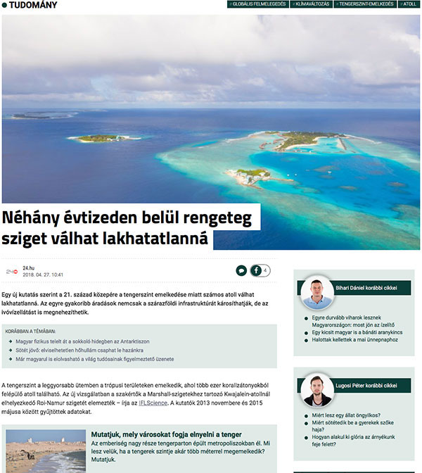
On April 27, 2018, Hungarian digital news outlet 24.hu published an article about a new USGS study showing that sea-level rise and wave-driven flooding could make many low-lying atoll islands uninhabitable by the mid-21st century by contaminating freshwater aquifers and damaging infrastructure. The headline reads: "Within a few decades, many islands may become uninhabitable."
A deluge of media coverage followed publication of a USGS-led study showing that sea-level rise and wave-driven flooding could make many low-lying atoll islands uninhabitable by the mid-21st century by contaminating freshwater aquifers and damaging infrastructure. The study appeared April 25 in Science Advances, and dozens of outlets reported it.
Some of those media outlets are:
Overseas coverage included:
One science writer in the UK wrote a poem about the research. The U.S. Department of Defense provided most of the funding and will use the results to plan for sea-level rise impacts on military installations in the Pacific.
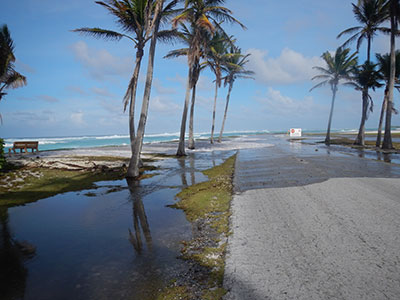
During a March 2, 2014 overwash event in the Republic of the Marshall Islands, seawater regularly topped the manmade perimeter berm on the island of Roi-Namur and covered large areas of the adjacent land surface. Photo by Peter Swarzenski, USGS [Read the article]
Sea-level rise and wave-driven flooding will negatively impact freshwater resources on many low-lying atoll islands in such a way that many could be uninhabitable in just a few decades.
According to a new study published in Science Advances, scientists found that such flooding not only will impact terrestrial infrastructure and habitats, but, more importantly, it will also make the limited freshwater resources non-potable and, therefore, directly threaten the sustainability of human populations.
Read the USGS News Release from April 25, 2018.
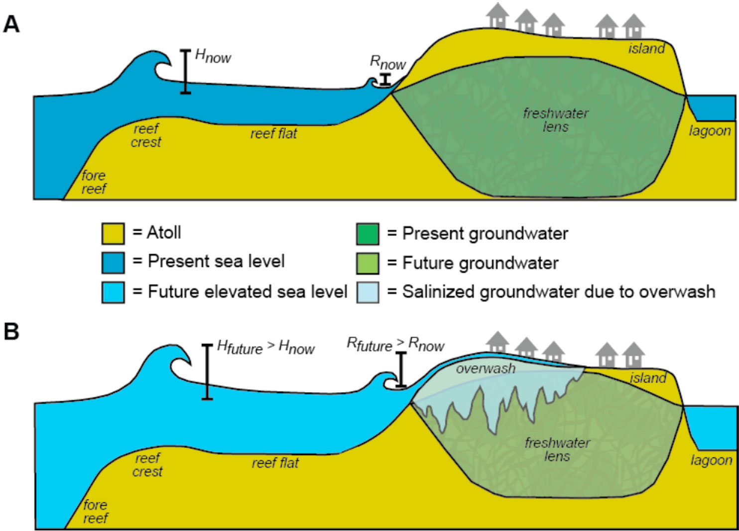
Conceptual diagram showing impact of sea-level rise and wave-driven flooding on atoll-island groundwater. (A) Current sea level. (B) Future sea level. Sea-level rise will allow for greater wave heights (H) and wave-driven runup (R), resulting in frequent overwash that will contaminate the atoll island’s freshwater lens. Note: Heights are exaggerated. [Larger version]
Sea-level rise and wave-driven flooding could introduce saltwater so frequently into atoll islands’ freshwater resources that many will be uninhabitable by the mid-21st century, according to a new study published in Science Advances. Scientists from the U.S. Geological Survey, Deltares, National Oceanic and Atmospheric Administration, and the University of Hawaiʻi at Mānoa focused fieldwork and model development on Roi-Namur Island on Kwajalein Atoll in the Republic of the Marshall Islands for this study. Researchers used several climate-change scenarios prescribed by the U.S. Department of Defense to project the impact of sea-level rise and wave-driven flooding on infrastructure and freshwater availability. Their findings can be applied to atolls around the world, most of which have, on average, even lower land elevations than Roi-Namur. The Department of Defense provided partial funding for the study and received results in an earlier report. Contact: Curt Storlazzi, [email protected], 831-460-7521

Screenshot from interactive documentary [View it here]
USGS research in the Republic of the Marshall Islands forms part of the scientific foundation of an interactive documentary released April 6 by PBS Frontline. “The Last Generation” profiles three children whose homeland in the Marshall Islands could become uninhabitable during their lifetimes. The producers incorporated information from interviews with research geologist Curt Storlazzi, who leads the USGS project “The Impact of Sea-Level Rise and Climate Change on Pacific Ocean Atolls that House Department of Defense Installations” (this site). Studies by Storlazzi and his colleagues show that the combined effects of climate change—particularly sea-level rise, storm-wave overwash, and reduced rainfall—could make living and working on atoll islands in the Republic of the Marshall Islands and elsewhere nearly impossible as early as 2035. Contact: Curt Storlazzi, [email protected], 831-460-7521

During a March 2, 2014 overwash event in the Republic of the Marshall Islands, seawater regularly topped the manmade perimeter berm on the island of Roi-Namur and covered large areas of the adjacent land surface. Photo by Peter Swarzenski, USGS [Larger version]
Living and working on the Pacific islands hosting a key missile tracking site soon could be almost impossible due to the impacts of climate change. In a report requested by the U.S. Department of Defense (DOD), the USGS and partners forecast that the “tipping point” – the time at which potable groundwater on Roi-Namur Island will be unavailable due to wave-driven flooding – is projected to be reached around the year 2035 for the most extreme scenario.
“Buildings, roads, and airports will be swamped by storm waves annually,” said lead author Dr. Curt Storlazzi, a USGS research geologist. “Yearly flooding by seawater, combined with slightly reduced rainfall, will result in the islands on Kwajalein Atoll not having a reliable natural source of fresh water. In the worst-case scenario, without significant infrastructure investments, many low-lying Pacific coral islands could reach a tipping point, becoming uninhabitable and unusable, before mid-century.”
Read the whole article here; and download the full report, titled “The Impact of Sea-Level Rise and Climate Change on Department of Defense Installations on Atolls in the Pacific Ocean (RC-2334).”
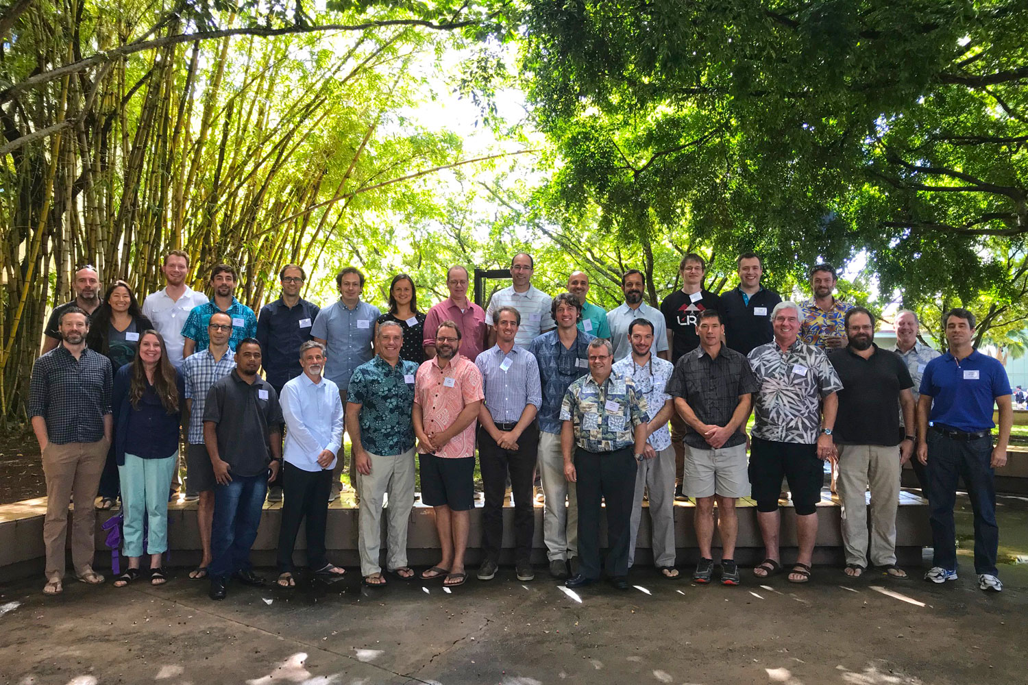
Participants at the workshop "Understanding Flooding on Reef-lined Island Coastlines." Workshop leader Curt Storlazzi is sixth from left in front row (flowered shirt). [Larger version]
USGS research geologist Curt Storlazzi led a workshop on “Understanding Flooding on Reef-lined Island Coastlines” (UFORIC) in Honolulu, Hawaiʻi, from 5–7 February. Participants assessed the state of the science, identified knowledge gaps, and explored ways to produce real-time flood forecasts and improve climate-change impact assessments. The meeting drew more than 30 experts from Australia, New Zealand, Fiji, the Republic of the Marshall Islands, Hawaiʻi, Spain, France, Belgium, the Netherlands, Germany, Israel, and the U.S. Topics included sea-level rise, wave climate (wave height, period, and direction in a particular location), how waves and water levels change as they move shoreward over coral reefs, and how coral reefs, reef-derived sediment, and the adjacent shorelines may evolve due to climate change. Storlazzi heads the USGS Coral Reef Project and The Impact of Sea-Level Rise and Climate Change on Pacific Ocean Atolls that House Department of Defense Installations project (this site). Contact: Curt Storlazzi, [email protected], 831-460-7521
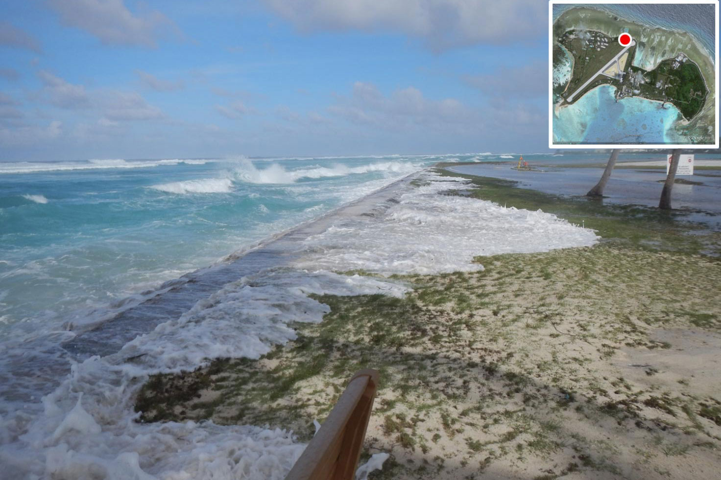
During the March 2, 2014 overwash event in the Republic of the Marshall Islands, seawater regularly topped the manmade perimeter berm on the island of Roi-Namur and covered large areas of the adjacent land surface. [Larger version]
Results of USGS research investigating sea-level rise impacts to Department of Defense (DoD) facilities in Pacific atolls are included in the National Defense Authorization Act for Fiscal Year 2018. This act, signed into law on December 12, 2017, authorizes and prioritizes funding for DoD military activities and construction. USGS scientists used Kwajalein Atoll in the Marshall Islands as a field site to fine-tune their computer models forecasting how rising sea-level and future storm waves will likely affect the sustainability of low-lying Pacific islands. The act reports their forecasts of flooding projected to threaten a major Air Force radar installation in the Republic of the Marshall Islands in upcoming decades. Contact: Curt Storlazzi, [email protected], 831-460-7521

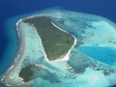
Aerial photograph of Kwajalein Atoll showing its low-lying islands and coral reefs. Photo by Tom Reiss, USGS [Larger version]
At the request of the U.S. Department of Defense (DoD) Strategic Environmental Research and Development Program (SERDP), USGS geologist Curt Storlazzi chaired a session at a conference on issues affecting DoD installations. The Strategic Environmental Research and Development Program (SERDP) and Environmental Security Technology Certification Program (ESTCP) Symposium took place in Washington, D.C., November 28-30. Storlazzi chaired the session Pacific and Arctic Environments—Unique Importance and Challenges, opening it with an invited overview talk. The session highlighted SERDP projects working to better understand how environmental factors affect DoD built and natural resources, and how climate change is projected to impact operations, infrastructure, freshwater availability, and ecosystems. Storlazzi leads the USGS project Impact of Sea-Level Rise and Climate Change on Pacific Ocean Atolls that House Department of Defense Installations. Contact: Curt Storlazzi, [email protected], 831-460-7521

Aerial photograph of Kwajalein Atoll showing its low-lying islands and coral reefs. Photo by Tom Reiss, USGS [Larger version]
Scientists have developed a new model called “BEWARE” (Bayesian Estimator of Wave Attack in Reef Environments) for predicting short-term flooding that threatens property and public safety on coral reef-lined coasts. BEWARE also assesses longer term impacts of sea-level rise on coastal flooding. This new tool estimates how combinations of wave, water level, and reef types lead to flooding. It allows users to test “what-if” scenarios and ask questions such as, “How will flood risk change if the coral reef dies, or if sea level rises by more than 1 meter?” The model can be used to project societal and economic risk and damage. The Dutch research institute Deltares, the USGS, and Delft University of Technology developed BEWARE. Read about it in the Journal of Geophysical Research: Oceans and in a news release from Deltares. Contact: Curt Storlazzi, [email protected], 831-460-7521
Source: https://pxhere.com/en/photo/837163. The image is released free of copyrights under Creative Commons CC0.
Read the entire article in this Deltares Press Release, November 2017.
Scientists have developed a computer simulation tool to predict short-term flood hazards on coral-reef-lined coasts and to assess longer-term impacts from climate change. The assessments will give input to estimate societal or economic risk and damage from such flooding. The tool can be used to play “what-if” games and ask questions such as, “how will flood risk change if the coral on this reef dies, or if sea level rises by more than 1 meter?” . . .
Read the entire article in this Deltares Press Release.
Story was also reprinted in AGU's GeoSpace blog.

Institute For Figuring's Crochet Coral Reef project, 2005-ongoing. Photo © the IFF.
Research oceanographer Curt Storlazzi (Pacific Coastal and Marine Science Center) served as a shallow-water coral expert in a panel discussion titled “Understanding Coral Reefs through Marine Science and Woolly Sculptures.” The free public event took place October 20, 2016, at the Seymour Marine Discovery Center, affiliated with the University of California, Santa Cruz (UCSC). Storlazzi was joined by deep-sea coral expert Matt McCarthy of UCSC and science communicator Margaret Wertheim. Wertheim’s projects include Crochet Coral Reef, the largest participatory art/science project in the world. The panel explored the interweaving of science and art, with a focus on coral reefs and the challenges that sea-level rise, climate change, and human-driven stressors pose to their health and sustainability. Contact: Curt Storlazzi, [email protected], 831-460-7521.
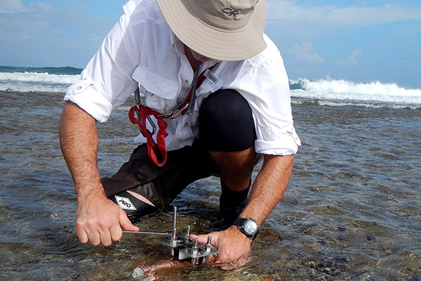
USGS oceanographer Curt Storlazzi deploying an oceanographic instrument package on the reef flat off Roi-Namur Island, Kwajalein Atoll, in the Republic of the Marshall Islands (RMI).
On the morning of May 3, 2016, USGS oceanographer Curt Storlazzi (Pacific Coastal and Marine Science Center) briefed the Department of Defense on coral reefs and climate change in the Pacific Ocean. That afternoon, he briefed the Department of the Interior and its Office of Insular Affairs. Storlazzi leads the USGS Pacific Coral Reefs project. Recent results show that climate change may reduce the ability of coral reefs to protect tropical islands against wave attack, erosion, and salinization of drinking-water resources (read the article). Storlazzi’s briefings described these and other findings, including the likely impacts of sea-level rise and climate change on Pacific atolls that house DoD installations.
Contact: Curt Storlazzi.
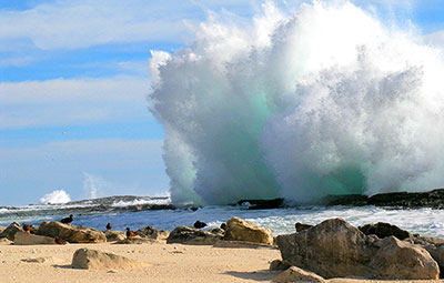
A 2012 photograph shows the impact of a large wave at the south shore of Laysan Island, with endangered Laysan teal in the foreground. Photo by Michele Reynolds. [Larger version]
A new study shows that the combined effect of storm-induced wave-driven flooding and sea level rise on island atolls may be more severe and happen sooner than previous estimates of inundation predicted by passive “bathtub” modeling for low-lying atoll islands, and especially at higher sea levels forecasted for the future due to climate change. More than half a million people live on atolls throughout the Pacific and Indian Oceans, and although the modeling was based on the Northwestern Hawaiian Islands, the results from the study apply to almost all atolls.
U.S. Geological Survey scientists and their colleagues at the Deltares Institute in the Netherlands, and the Hawaii Cooperative Studies Unit at University of Hawaii, Hilo report that numerical modeling reveals waves will synergistically interact with sea level rise, causing twice as much land forecast to be flooded for a given future sea level than currently predicted by models that do not take wave-driven water levels into account.
Observations show global sea level is rising due to climate change, with the highest rates in the tropical Pacific Ocean where many of the world’s low-lying atolls are located. Sea level rise is particularly critical for low-lying coral reef-lined atoll islands; these islands have limited land and water available for human habitation, limited food sources and ecosystems that are vulnerable to inundation from sea level rise. Sea level rise will result in larger waves and higher wave-driven water levels along atoll islands’ shorelines than at present.
“Many atoll islands will be flooded annually, contaminating the limited freshwater resources with saltwater, and likely forcing inhabitants to abandon their islands in decades, not centuries, as previously thought,” said USGS geologist and lead author of the study, Curt Storlazzi.
The study explored the combined effect of storm-induced wave-driven flooding and sea level rise on atoll islands within the Northwestern Hawaiian Islands, including Laysan and Midway Islands, which are home to many threatened and endangered endemic species. The same modeling approach is applicable to most populated atolls around the world.
Read this USGS news release, and learn more about the study, published in Nature's Scientific Reports.
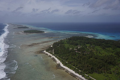
Aerial photograph of Kwajalein Atoll in the Republic of the Marshall Islands, showing its low-lying islands and coral reefs. The line of breaking waves on the left marks the reef crest, where much of the waves' energy is dissipated. Additional energy is lost through friction as the water flows shoreward over the rough surface of the healthy reef flat. USGS photograph taken May 2015 by Tom Reiss. [Larger version]
Climate change may reduce the ability of coral reefs to protect tropical islands against wave attack, erosion, and salinization of the drinking-water resources that help to sustain life on those islands. A new paper by researchers from the Dutch independent institute for applied research Deltares and the USGS gives guidance to coastal managers to assess how climate change will affect a coral reef’s ability to mitigate coastal hazards.
In order to prevent or mitigate these impacts, coastal managers need know to what extent their reef system may lose its protective function so that they can take action. The new paper, titled "The influence of coral reefs and climate change on wave-driven flooding of tropical coastlines," gives guidance on a local reef's sensitivity to change. It was published 4 August 2015 in Geophysical Research Letters, a journal of the American Geophysical Union.
Read the entire article.
Aerial photograph of Kwajalein Atoll showing its low-lying islands and coral reefs. Photograph by Curt Storlazzi. [Larger version]
Coral reefs, under pressure from climate change and direct human activity, may have a reduced ability to protect tropical islands against wave attack, erosion and salinization of drinking water resources, which help to sustain life on those islands. A new paper by researchers from the Dutch independent institute for applied research Deltares and the U.S. Geological Survey gives guidance to coastal managers to assess how climate change will affect a coral reef’s ability to mitigate coastal hazards.
The article is titled, “The influence of coral reefs and climate change on wave-driven flooding of tropical coastlines,” and is available online at doi:10.1002/2015GL064861
Read this USGS news release.
Learn more about coral reefs and climate change on our Pacific Coral Reefs Web Site.
Read more about our research on the impacts on low-lying areas of tropical Pacific islands.
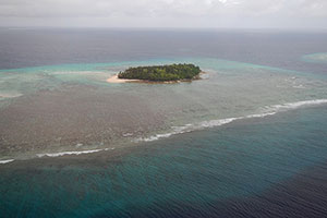
Aerial photograph of waves breaking on the fringing reef off Ennuebing Island, Kwajalein Atoll, Republic of the Marshall Islands. From cover of “Future Wave and Wind Projections for United States and United States-Affiliated Pacific Islands.”
According to a report released in January 2015 by the U.S. Geological Survey (USGS), climate changes during the 21st century are expected to alter the highest waves and strongest winds across U.S. and U.S.-affiliated Pacific islands.
“With little to no publicly available historical wind and wave data for most of the U.S.-affiliated Pacific islands, and no future projections of waves and winds for different climate scenarios, there was a great science and management need to understand how waves and wind might change in future climates,” said Curt Storlazzi, USGS oceanographer and lead author of the study.
Scientists from the USGS and the University of California, Santa Cruz (UCSC) ran four global climate models (developed for the Intergovernmental Panel on Climate Change), using them to drive a global-wave model to look at projected changes in wave height, wave period, wave direction, wind speed, and wind direction. They focused on three Hawaiian Islands and 22 other locations on U.S.-affiliated islands in the Pacific Ocean. Modeling results project that wind and wave patterns will change over the years throughout the century, and also over certain months and seasons within each year.
Read the entire article.
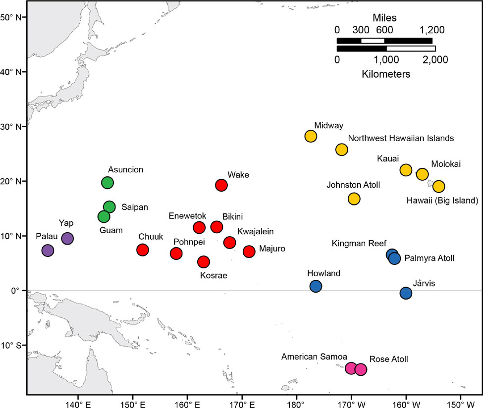
Map showing the locations of the 25 modeled points within the tropical Pacific Ocean used in this study. [Larger version]
According to a new USGS report, climate changes during the 21st century are expected to alter the highest waves and strongest winds across U.S. and U.S.-affiliated islands in the Pacific Ocean. Wave and wind processes drive flooding of coastal land, potentially damaging islands’ infrastructure, fresh-water supplies, and natural resources, and harming federally protected species such as nesting seabirds. Scientists from USGS and the University of California, Santa Cruz, used computer models to look at how climate change will affect wave heights, periods, and directions, and wind speed and direction. Their detailed calculations will be useful for managers developing coastal resilience plans or ecosystem restoration efforts, and for engineers designing future infrastructure. This research was supported by the Pacific Islands Climate Change Cooperative (http://piccc.net/). USGS Open-File Report 2015-1001 is posted at https://doi.org/10.3133/ofr20151001. For more information, contact Curt Storlazzi, [email protected], 831-460-7521.

Photo of overwash damage on Majuro; credit: University of Hawaii Sea Grant College Program. [Larger version]
USGS research geologist Curt Storlazzi briefed Ambassador Armbruster and his staff at the U.S. Embassy on Majuro in the Republic of the Marshall Islands (RMI) on May 8–9, 2014. Storlazzi explained the project he leads, “The Impact of Sea-Level Rise and Climate Change on Department of Defense Installations on Atolls in the Pacific Ocean,” as well as other USGS efforts to understand climate-change and sea-level-rise impacts on atolls. RMI consists mainly of low-lying atolls already threatened by sea-level rise and changing climate. In March 2014, a combination of unusually high tides and waves flooded the capital for the third time in a year and led RMI’s president to declare a state of emergency. For more information, contact Curt Storlazzi, 831-460-7521, [email protected].
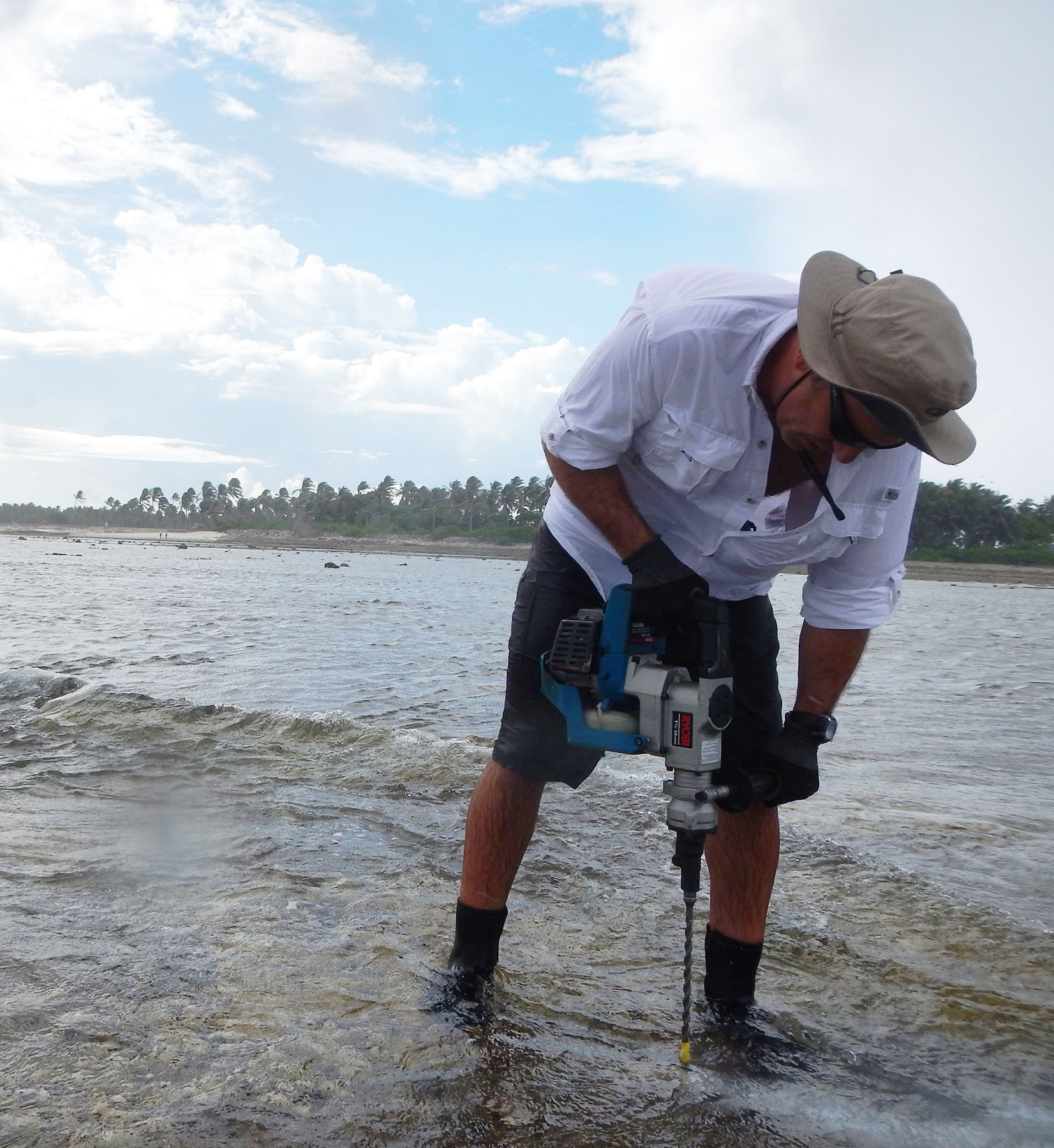
Fieldwork on Kwajalein Atoll: Curt Storlazzi installs wave/tide gauge mounts on the reef flat off Roi-Namur Island. [Larger version]
USGS scientists from the Pacific Coastal and Marine Science Center conducted fieldwork on Kwajalein Atoll in the Republic of the Marshall Islands with collaborators from the National Oceanic and Atmospheric Administration (NOAA) April 20–May 7, 2014. Scientists from NOAA’s National Centers for Coastal Ocean Science (NCCOS) and Center for Coastal Fisheries and Habitat Research (CCFHR) joined the USGS researchers to gather data on bathymetry, topography, tides, waves, run-up, and the resulting wave-driven inundation of the atoll islands. The work is part of a project funded by the Department of Defense (DoD) to assess the impacts of sea-level rise and climate change on Pacific atolls that house DoD installations. The findings will also be useful to Pacific island nations already threatened by sea-level rise and changing climate. For more information, contact Curt Storlazzi, 831-460-7521, [email protected].
During the 2 March 2014 overwash event in the Republic of the Marshall Islands, seawater regularly topped the manmade perimeter berm on the island of Roi-Namur and covered large areas of the adjacent land surface. [Larger version]
Pacific atolls and the people who live on them are well known to be among the most vulnerable to the impacts of future climate change and sea-level rise. The USGS is leading a multiagency project to assess the impacts of sea-level rise and storm-wave inundation on small Pacific atoll islets and their freshwater resources under various sea-level rise and climatic scenarios. In March 2014, instruments deployed by the project unexpectedly recorded an event that demonstrates the work’s importance: a combination of unusually high tides and large swells that flooded many areas within the Republic of the Marshall Islands.
Read the entire article in the March/April 2014 issue of USGS Sound Waves Newsletter.
High tide at a groundwater sampling site at Roi-Namur Island, Kwajalein Atoll, November 2013. [Larger version]
Peter Swarzenski of the USGS Pacific Coastal and Marine Science Center continued studies of the coastal aquifer of Roi-Namur Island, Kwajalein Atoll, February 23–March 3, 2014. Swarzenski is investigating underground freshwater and saltwater using geochemical and geophysical techniques, including trace metal, nutrient, and carbon geochemistry; radon isotope analysis; piezometry; thermal conductivity; and electrical resistivity. This work is part of a joint study for the Department of Defense, Strategic Environmental Research and Development Program (SERDP) by USGS, NOAA, and the University of Hawaii, to assess impacts of sea-level rise and storm-wave inundation on infrastructure and freshwater under various sea-level rise and climate scenarios. DoD will use the findings to develop climate-change adaptation plans for infrastructure and water resources. The findings also will be useful to Pacific island
nations threatened by sea-level rise and climate change.
