USGS Coastal and Marine Hazards and Resources Program
![]() Title |
Figures |
1-Introduction |
2-Data Collection and Processing |
3- Geologic Interpretation |
4-References |
5-Maps |
Spatial Data |
Acknowledgments
Title |
Figures |
1-Introduction |
2-Data Collection and Processing |
3- Geologic Interpretation |
4-References |
5-Maps |
Spatial Data |
Acknowledgments
 |
||
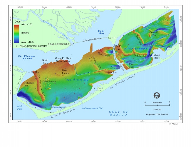
Figure 6. Map showing the names of bay-floor and geographic features within the Apalachicola Bay study area. Locations of sediment samples collected by NOAA Coastal Services Center (NOAA, 1999) that were used to verify the sidescan-sonar interpretation are shown. | ||
