USGS Coastal and Marine Hazards and Resources Program
![]() Title |
Figures |
1-Introduction |
2-Data Collection and Processing |
3- Geologic Interpretation |
4-References |
5-Maps |
Spatial Data |
Acknowledgments
Title |
Figures |
1-Introduction |
2-Data Collection and Processing |
3- Geologic Interpretation |
4-References |
5-Maps |
Spatial Data |
Acknowledgments
 |
||
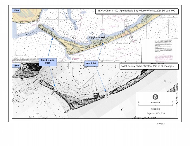
Figure 7. 2000 NOAA chart # 11402 (top panel) and 1860 NOAA chart # 485 (bottom panel) showing the location of New Inlet, a former tidal inlet near Higgins Shoal that presently is sealed (NOAA, 1860; 2000). | ||
