USGS Coastal and Marine Hazards and Resources Program
![]() Title |
Figures |
1-Introduction |
2-Data Collection and Processing |
3- Geologic Interpretation |
4-References |
5-Maps |
Spatial Data |
Acknowledgments
Title |
Figures |
1-Introduction |
2-Data Collection and Processing |
3- Geologic Interpretation |
4-References |
5-Maps |
Spatial Data |
Acknowledgments
 |
||
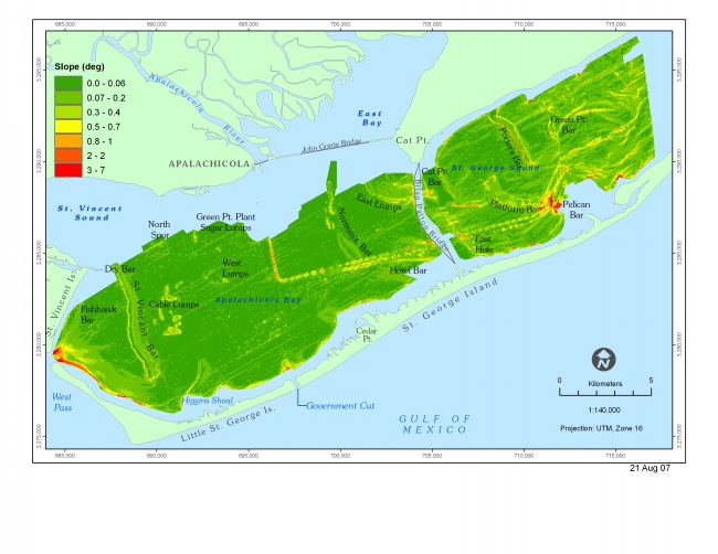
Figure 9. Map showing the slope of the bay floor. The steepest slopes are found along the flanks of the Intracoastal Waterway, along the margins of the bay, and on the western sides of linear bars (eg. St. Vincent's Bar and Porter's Bar). | ||