Geographic Locations of Seabed Sediment Samples from the Stellwagen Bank National Marine Sanctuary Region (SB_SEDSAMPLES Shapefile)

Metadata also available as - [Outline] - [Parseable text] - [XML]

Frequently anticipated questions:


What does this data set describe?

Title:
Geographic Locations of Seabed Sediment Samples from the Stellwagen Bank National Marine Sanctuary Region (SB_SEDSAMPLES Shapefile)
Abstract:
The U.S. Geological Survey, in collaboration with the National Oceanic and Atmospheric Administration's (NOAA) National Marine Sanctuary Program, conducted seabed mapping and related research in the Stellwagen Bank National Marine Sanctuary region from 1993 to 2004. The mapped area is approximately 3,700 square km (1,100 square nm) in size and was subdivided into 18 quadrangles. Several series of sea floor maps of the region based on multibeam sonar surveys have been published. In addition, 2,628 seabed sediment samples were collected and analyzed and approximately 10,600 still photographs of the seabed were acquired during the project. These data provide the basis for scientists, policymakers, and managers for understanding the complex ecosystem of the sanctuary region and for monitoring and managing its economic and natural resources.
Supplemental_Information:
These data are provided in shapefile format covering the entire Stellwagen Bank study area. The metadata bounding coordinates refers to the whole dataset.
  1. How might this data set be cited?
    Gallea, Leslie B., 2009, Geographic Locations of Seabed Sediment Samples from the Stellwagen Bank National Marine Sanctuary Region (SB_SEDSAMPLES Shapefile): U.S. Geological Survey Data Series 469, U.S. Geological Survey, Coastal and Marine Geology Program, Woods Hole Coastal and Marine Science Center, Woods Hole, MA.

    Online Links:

    This is part of the following larger work.

    Valentine, Page C., Gallea, Leslie B., Blackwood, Dann S., and Twomey, Erin R., 2009, Seabed Photographs, Sediment Texture Analyses, and Sun-illuminated Sea Floor Topography in the Stellwagen Bank National Marine Sanctuary Region off Boston, Massachusetts: U.S. Geological Survey Data Series 469, U.S. Geological Survey, Reston, VA.

    Online Links:

  2. What geographic area does the data set cover?
    West_Bounding_Coordinate: -70.597750
    East_Bounding_Coordinate: -70.033220
    North_Bounding_Coordinate: 42.798900
    South_Bounding_Coordinate: 42.084650
  3. What does it look like?
    https://pubs.usgs.gov/ds/469/DataCatalog/sb_sedsamples.jpg (JPEG)
    thumbnail image of seabed sediment sample locations
  4. Does the data set describe conditions during a particular time period?
    Beginning_Date: 1993
    Ending_Date: 2004
    Currentness_Reference:
    ground condition
  5. What is the general form of this data set?
    Geospatial_Data_Presentation_Form: vector digital data
  6. How does the data set represent geographic features?
    1. How are geographic features stored in the data set?
      This is a Vector data set. It contains the following vector data types (SDTS terminology):
      • Entity point (2628)
    2. What coordinate system is used to represent geographic features?
      Horizontal positions are specified in geographic coordinates, that is, latitude and longitude. Latitudes are given to the nearest 0.000001. Longitudes are given to the nearest 0.000001. Latitude and longitude values are specified in Decimal degrees. The horizontal datum used is North American Datum of 1983.
      The ellipsoid used is Geodetic Reference System 80.
      The semi-major axis of the ellipsoid used is 6378137.000000.
      The flattening of the ellipsoid used is 1/298.257222.
  7. How does the data set describe geographic features?
    sb_sedsamples
    shapefile (Source: U.S. Geological Survey)
    FID
    Internal feature number. (Source: ESRI) Sequential unique whole numbers that are automatically generated.
    Shape
    Feature geometry. (Source: ESRI) Coordinates defining the features.
    USGS_SBNMS
    Station number for samples collected during this project in the Stellwagen Bank National Marine Sanctuary region off Boston, Massachusetts. The stations were named using a number and in some instances a letter (3131a) or a decimal number (3131.1) suffix was appended. During the project, this station numbering scheme was not consistent, so that some station names used one format and some the other. For example, station 3131.1 is now named 3131a. (Source: U.S. Geological Survey) Character set
    USGS_DBID
    Sediment database identification number for analyzed sediment samples collected in the Stellwagen Bank National Marine Sanctuary region. (Source: Information unavailable from original metadata.) Information unavailable from original metadata.
    Longitude
    Longitude west (decimal degrees, NAD83) of sediment sample location. (Source: U.S. Geological Survey)
    Range of values
    Minimum:-70.597750
    Maximum:-70.033220
    Latitude
    Latitude north (decimal degrees, NAD83) of sediment sample location (Source: U.S. Geological Survey)
    Range of values
    Minimum:42.084650
    Maximum:42.798900
    WHCMSC_Fie
    USGS Woods Hole Coastal and Marine Science Center Field Activity (cruise) number. Example: andr is the vessel name code (andr is short for Peter W. Anderson); 95036 is USGS Woods Hole Coastal and Marine Science Center Field Activity number, where 95 is last two digits of the year, and 036 is the third field activity of the year. (Source: U.S. Geological Survey)
    Formal codeset
    Codeset Name:ablj97020
    Codeset Source:https://cmgds.marine.usgs.gov/fan_info.php?fan=1997-020-FA
    Formal codeset
    Codeset Name:andr95015
    Codeset Source:https://cmgds.marine.usgs.gov/fan_info.php?fan=1995-015-FA
    Formal codeset
    Codeset Name:andr95036
    Codeset Source:https://cmgds.marine.usgs.gov/fan_info.php?fan=1995-036-FA
    Formal codeset
    Codeset Name:argo94014
    Codeset Source:https://cmgds.marine.usgs.gov/fan_info.php?fan=1994-014-FA
    Formal codeset
    Codeset Name:cand00065
    Codeset Source:https://cmgds.marine.usgs.gov/fan_info.php?fan=2000-065-FA
    Formal codeset
    Codeset Name:cand98022
    Codeset Source:https://cmgds.marine.usgs.gov/fan_info.php?fan=1998-022-FA
    Formal codeset
    Codeset Name:conn03014
    Codeset Source:https://cmgds.marine.usgs.gov/fan_info.php?fan=2003-014-FA
    Formal codeset
    Codeset Name:dian96025
    Codeset Source:https://cmgds.marine.usgs.gov/fan_info.php?fan=1996-025-FA
    Formal codeset
    Codeset Name:dlwr93006
    Codeset Source:https://cmgds.marine.usgs.gov/fan_info.php?fan=1993-006-FA
    Formal codeset
    Codeset Name:dlwr93030
    Codeset Source:https://cmgds.marine.usgs.gov/fan_info.php?fan=1993-030-FA
    Formal codeset
    Codeset Name:dlwr99011
    Codeset Source:https://cmgds.marine.usgs.gov/fan_info.php?fan=1999-011-FA
    Formal codeset
    Codeset Name:ferl00011
    Codeset Source:https://cmgds.marine.usgs.gov/fan_info.php?fan=2000-011-FA
    Formal codeset
    Codeset Name:ferl02029
    Codeset Source:https://cmgds.marine.usgs.gov/fan_info.php?fan=2002-029-FA
    Formal codeset
    Codeset Name:ferl94004
    Codeset Source:https://cmgds.marine.usgs.gov/fan_info.php?fan=1994-004-FA
    Formal codeset
    Codeset Name:ferl95012
    Codeset Source:https://cmgds.marine.usgs.gov/fan_info.php?fan=1995-012-FA
    Formal codeset
    Codeset Name:ferl96038
    Codeset Source:https://cmgds.marine.usgs.gov/fan_info.php?fan=1996-038-FA
    Formal codeset
    Codeset Name:ferl97033
    Codeset Source:https://cmgds.marine.usgs.gov/fan_info.php?fan=1997-033-FA
    Formal codeset
    Codeset Name:ferl98029
    Codeset Source:https://cmgds.marine.usgs.gov/fan_info.php?fan=1998-029-FA
    Formal codeset
    Codeset Name:isbl96037
    Codeset Source:https://cmgds.marine.usgs.gov/fan_info.php?fan=1996-037-FA
    Formal codeset
    Codeset Name:isbl98017
    Codeset Source:https://cmgds.marine.usgs.gov/fan_info.php?fan=1998-017-FA
    Formal codeset
    Codeset Name:isbl99024
    Codeset Source:https://cmgds.marine.usgs.gov/fan_info.php?fan=1999-024-FA
    Formal codeset
    Codeset Name:andr93023
    Codeset Source:https://cmgds.marine.usgs.gov/fan_info.php?fan=1993-023-FA
    Formal codeset
    Codeset Name:fstr04010
    Codeset Source:https://cmgds.marine.usgs.gov/fan_info.php?fan=2004-010-FA
    Formal codeset
    Codeset Name:conn01060
    Codeset Source:https://cmgds.marine.usgs.gov/fan_info.php?fan=2001-060-FA
    Water_Dept
    Depth of water at some station locations measured by the ship's fathometer and at other station locations by the SEABOSS depth sensor. (Source: U.S. Geological Survey)
    Range of values
    Minimum:15
    Maximum:190
    Units:meters
    Year
    Year seabed sediment sample collected (Source: U.S. Geological Survey)
    Range of values
    Minimum:1993
    Maximum:2004
    Julian_Day
    Julian Date and Time GMT: Julian Day:HH:MM:SS seabed sediment sample collected (Source: U.S. Geological Survey) Information unavailable from original metadata.
    Quad
    Geographic Location: Quadrangle Number in Stellwagen Bank National Marine Sanctuary region (Source: U.S. Geological Survey) Character set
    Sampler_us
    Sampler used USGS Van Veen: sediment sample collected using a USGS modified Van Veen (VV) grab sampler (Source: U.S. Geological Survey) Character set
    Sed_smpl_t
    Sediment sample top relative to seabed, cm: depth of top of sediment sample is the seabed surface (0 cm) (Source: U.S. Geological Survey)
    ValueDefinition
    0Information unavailable from original metadata.
    Sed_smpl_b
    Sediment sample bottom relative to seabed, cm: depth of bottom of sediment sample is 2 cm below the seabed surface (Source: U.S. Geological Survey)
    ValueDefinition
    2Depth in sediment in cm
    Sediment_s
    Dry weight sediment sample analyzed mass, g: mass of sediment used for grain size analysis in grams (Source: U.S. Geological Survey)
    Range of values
    Minimum:7.4195
    Maximum:1727.1
    Units:grams
    Resolution:0.01
    Clay_wt_pe
    Weight percent clay in dry sample (Source: U.S. Geological Survey)
    Range of values
    Minimum:0
    Maximum:52.3
    Units:percent
    Resolution:0.01
    Silt_wt_pe
    Weight percent silt in dry sample (Source: U.S. Geological Survey)
    Range of values
    Minimum:0
    Maximum:86.8
    Units:percent
    Resolution:0.01
    Mud
    Weight percent mud (combined clay and silt) in dry sample (Source: U.S. Geological Survey)
    Range of values
    Minimum:0
    Maximum:99.45
    Units:percent
    Resolution:0.01
    Sand_wt_pe
    Weight percent sand in dry sample (Source: U.S. Geological Survey)
    Range of values
    Minimum:0.55
    Maximum:100
    Units:percent
    Resolution:0.01
    Gravel_wt
    Weight percent gravel in dry sample (Source: U.S. Geological Survey)
    Range of values
    Minimum:0
    Maximum:98.21
    Units:percent
    Resolution:0.01
    11_phi_siz
    Weight percent of 11 phi size sediment in dry sample (fine clay) (Source: U.S. Geological Survey)
    Range of values
    Minimum:0
    Maximum:12.07
    Units:percent
    Resolution:0.01
    10_phi_siz
    Weight percent of 10 phi size sediment in dry sample (medium clay) (Source: U.S. Geological Survey)
    Range of values
    Minimum:0
    Maximum:21.55
    Units:percent
    Resolution:0.01
    9_phi_size
    Weight percent of 9 phi size sediment in dry sample (coarse clay) (Source: U.S. Geological Survey)
    Range of values
    Minimum:0
    Maximum:23.89
    Units:percent
    Resolution:0.01
    8_phi_size
    Weight percent of 8 phi size sediment in dry sample (very fine silt) (Source: U.S. Geological Survey)
    Range of values
    Minimum:0
    Maximum:27.23
    Units:percent
    Resolution:0.01
    7_phi_size
    Weight percent of 7 phi size sediment in dry sample (fine silt) (Source: U.S. Geological Survey)
    Range of values
    Minimum:0
    Maximum:27.4
    Units:percent
    Resolution:0.01
    6_phi_size
    Weight percent of 6 phi size sediment in dry sample (medium silt) (Source: U.S. Geological Survey)
    Range of values
    Minimum:0
    Maximum:32.9
    Units:percent
    Resolution:0.01
    5_phi_size
    Weight percent of 5 phi size sediment in dry sample (coarse silt) (Source: U.S. Geological Survey)
    Range of values
    Minimum:0
    Maximum:55.92
    Units:percent
    Resolution:0.01
    4_phi_size
    Weight percent of 4 phi size sediment in dry sample (very fine sand) (Source: U.S. Geological Survey)
    Range of values
    Minimum:0
    Maximum:89.77
    Units:percent
    Resolution:0.01
    3_phi_size
    Weight percent of 3 phi size sediment in dry sample (fine sand) (Source: U.S. Geological Survey)
    Range of values
    Minimum:0
    Maximum:89.19
    Units:percent
    Resolution:0.01
    2_phi_size
    Weight percent of 2 phi size sediment in dry sample (medium sand) (Source: U.S. Geological Survey)
    Range of values
    Minimum:0
    Maximum:84.54
    Units:percent
    Resolution:0.01
    1_phi_size
    Weight percent of 1 phi size sediment in dry sample (coarse sand) (Source: U.S. Geological Survey)
    Range of values
    Minimum:0
    Maximum:74.01
    Units:percent
    Resolution:0.01
    0_phi_size
    Weight percent of 0 phi size sediment in dry sample (very coarse sand) (Source: U.S. Geological Survey)
    Range of values
    Minimum:0
    Maximum:69.16
    Units:percent
    Resolution:0.01
    1_phi_siz
    Weight percent of -1 phi size sediment in dry sample (very fine pebbles-granules) (Source: U.S. Geological Survey)
    Range of values
    Minimum:0
    Maximum:84.97
    Units:percent
    Resolution:0.01
    2_phi_siz
    Weight percent of -2 phi size sediment in dry sample (fine pebbles) (Source: U.S. Geological Survey)
    Range of values
    Minimum:0
    Maximum:31.65
    Units:percent
    Resolution:0.01
    3_phi_siz
    Weight percent of -3 phi size sediment in dry sample (medium pebbles) (Source: U.S. Geological Survey)
    Range of values
    Minimum:0
    Maximum:50.65
    Units:percent
    Resolution:0.01
    4_phi_siz
    Weight percent of -4 phi size sediment in dry sample (coarse pebbles) (Source: U.S. Geological Survey)
    Range of values
    Minimum:0
    Maximum:65.78
    Units:percent
    Resolution:0.01
    5_phi_siz
    Weight percent of -5 phi size sediment in dry sample (very coarse pebbles to cobbles) (Source: U.S. Geological Survey)
    Range of values
    Minimum:0
    Maximum:61.76
    Units:percent
    Resolution:0.01
    Entity_and_Attribute_Overview:
    Geographic location and textural data from seabed sediment samples taken from the Stellwagen Bank National Marine Sanctuary region. There are no blank fields in the data. If a zero is present in any row, then the sample had zero phi percent or zero weight percent of the field description.
    Entity_and_Attribute_Detail_Citation: U.S. Geological Survey

Who produced the data set?

  1. Who are the originators of the data set? (may include formal authors, digital compilers, and editors)
    • Leslie B. Gallea
  2. Who also contributed to the data set?
  3. To whom should users address questions about the data?
    Page C. Valentine
    U.S. Geological Survey
    Research Geologist
    384 Woods Hole Road
    Woods Hole, MA
    USA

    (508) 548-8700 x2339 (voice)
    (508) 457-2310 (FAX)
    pvalenting@usgs.gov

Why was the data set created?

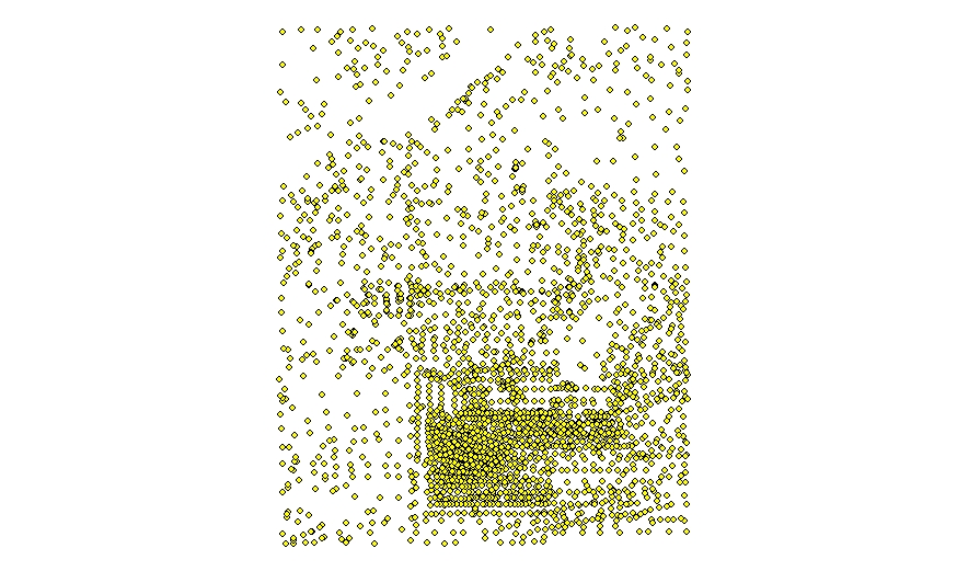
These data provide the locations of seabed sediment samples taken in the Stellwagen Bank National Marine Sanctuary region from 1993 to 2004. In addition to location information, the data also provides sediment analyses of each sample. See attribute section for complete description. The data for all of Stellwagen Bank is available as a shapefile.

How was the data set created?

  1. From what previous works were the data drawn?
  2. How were the data generated, processed, and modified?
    Date: unknown (process 1 of 9)
    The SEABed Observation and Sampling System (SEABOSS) was designed by the U.S. Geological Survey (USGS) for rapid and effective collection of seabed images and sediment samples in coastal regions. The observations from video and still cameras and the sediment data are used to explore the nature of the seafloor and, in conjunction with high-resolution geophysical data, to make interpretive maps of sedimentary environments and validate the acoustic remote sensing data. The SEABOSS is a simple system that can be deployed from both small and large surface vessels and operates in water depths up to 200 m. It incorporates two video cameras, a still camera, a depth sensor, and a modified Van Veen sediment sampler. The elements of the SEABOSS system used on Stellwagen Bank are housed within a stainless steel framework that measures 1.2 x 1.2 meters and weighs approximately136 kilograms overall. The frame has a stabilizer fin that orients the system as it drifts over the seabed. The height of the camera above the seabed (76 cm; 30 in) initially was determined by viewing an object hanging from the SEABOSS below the video camera; when the object touched the seabed, the camera height was appropriate for still photography. Later in the project, the camera height was determined by viewing a pattern of laser beams on the seabed. Two parallel lasers are set 20 cm apart on the SEABOSS frame and project onto the seabed for scale measurements. All of the system's elements are powered from the surface vessel through a conducting cable. Video displays include station number, water depth (from the depth sensor), and date, time, and geographic position (provided by a shipboard navigation system). During deployment, the camera system hangs directly below the side of the ship, and the recorded navigation data closely approximates the position of the camera system near the seabed. The ship is oriented so that wind and waves will not cause it to drift over the conducting cable attached to the SEABOSS. The winch operator uses a video feed from the system to maintain the camera at the proper height above the seabed and to avoid obstacles. The scientist uses the video to decide when to take a grab sample of seabed sediment.
    Date: 2004 (process 2 of 9)
    Annual research cruises visited stations from 1993-2004 and took seabed sediment samples using the SEABOSS that was equipped with a modified Van Veen grab sampler, a still camera and video cameras. The modified Van Veen sediment grab sampler is located in the center of the SEABOSS frame. Before deployment, the grab's buckets (jaws) are opened by collapsing the extended arms to a near-horizontal position and locking them in place with two catches. The sampler operates passively to sample the seabed; it is not spring-loaded. To collect a sample, the SEABOSS is lowered to rest gently on the seabed, and the time is recorded for navigation purposes. When the cable is slack, the two locking catches automatically release by gravity. As the cable is retrieved, the grab sampler's arms are pulled upward closing the bucket around the sediment, and the SEABOSS is lifted off the seabed. Weight can be added to the SEABOSS frame, making it harder to lift off the seabed, which results in the grab buckets closing more tightly around the sediment. The SEABOSS is retrieved and set upon a wooden platform that keeps the sampler buckets and camera systems above the deck. The sampler's arms are maintained in the upright position by holding them or by maintaining tension on the cable; the doors on the upper sides of the buckets are opened; and the sediment is retrieved. For this project, the upper 2 cm of sediment, representing the surface of the seabed, was removed with a rectangular shovel 2-cm deep and stored in a plastic bag for analysis ashore. The remaining sediment was dumped into a tray located on the deck below the sampler, and the Van Veen grab was washed in preparation for the next site. Processing spanned the time period 1993 to 2004. Person who carried out this activity:
    Page C. Valentine
    U.S. Geological Survey
    Research Geologist
    384 Woods Hole Road
    Woods Hole, MA
    USA

    (508) 548-8700 x 2339 (voice)
    (508) 457-2310 (FAX)
    pvalentine@usgs.gov
    Date: 2004 (process 3 of 9)
    Grain size analyses of the 2628 sediment samples collected were performed at the USGS Woods Hole Coastal and Marine Science Center in Woods Hole, MA using a standard suite of analytical methods. Processing included the following steps: coarse fraction determined by sieve; fine fraction determined by Coulter Counter. Processing spanned the time period 1993 to 2004. Person who carried out this activity:
    Larry J. Poppe
    U.S. Geological Survey
    Geologist
    384 Woods Hole Road
    Woods Hole, MA
    USA

    (508) 548-8700 x2314 (voice)
    (508) 548-8700 x2314 (FAX)
    lpoppe@usgs.gov
    Date: 2009 (process 4 of 9)
    Station sediment sample analyses records were exported from the lab's database using Microsoft Excel 2007 (12.0.6504.5001) SP2 MSO (12.0.6425.1000). Some fields were deleted from the sediment lab analysis report that are unnecessary to our purpose. A mud weight percent column was added to the exported Excel spreadsheet since mud was found to be an important seabed characteristic in the Stellwagen region. Second, a quad column was added to organize the data into eighteen individual quadrangles. Third, Julian Day and time was complied in another column. Fourth an original Excel column, "Field ID" was reformatted as a text field for ease of import into ArcGIS. The reason being during the project, the station numbering scheme was not consistent, so that some station names used a decimal number format and some a number and letter format. For the purpose of this report, all sediment sample stations were renamed using the number and letter format for the station name where necessary. For example, station 3131.1 is now named 3131a. Lastly, headers were applied to the exported sediment sample Excel file. A check of the exported data was conducted against the lab's database to ensure consistency. Person who carried out this activity:
    Leslie B. Gallea
    U.S. Geological Survey
    GIS Specialist
    384 Woods Hole Road
    Woods Hole, MA
    USA

    (508) 548-8700 x2341 (voice)
    (508) 457-2310 (FAX)
    lgallea@usgs.gov
    Date: 2009 (process 5 of 9)
    Using the sediment sample MS Excel spreadsheet of all seabed sediment samples taken in the 18 quadrangles, a shapefile was created in ESRI ArcCatalog 9.3.1.1850 by selecting the sediment sample excel table, right clicking on the table and selecting the "Create Feature Class" from "XY table" option in the drop-down menu. In the popup window that displays after selecting Create Feature Class, Longitude was applied to the "X Field" and Latitude was applied to the "Y Field". Next, clicking on "The Coordinate System of Input Coordinates" opens a second window where "Select a predefined coordinated system" was chosen. Navigate to Geographic Coordinate Systems North American Datum 1983, which will give the shapefile a projection in GCS NAD1983 (GRS 80). Lastly, specify an output for the shapefile. Person who carried out this activity:
    Leslie B. Gallea
    U.S. Geological Survey
    GIS Specialist
    384 Woods Hole Road
    Woods Hole, MA
    USA

    (508) 548-8700 x2341 (voice)
    (508) 457-2310 (FAX)
    lgallea@usgs.gov
    Data sources produced in this process:
    • sb_sedsamples.zip
    Date: 19-Oct-2017 (process 6 of 9)
    Edits to the metadata were made to fix any errors that MP v 2.9.36 flagged. This is necessary to enable the metadata to be successfully harvested for various data catalogs. In some cases, this meant adding text "Information unavailable" or "Information unavailable from original metadata" for those required fields that were left blank. Other minor edits were probably performed (title, publisher, publication place, etc.). The link to the data in the Identification_Information section had to be fixed. Attempted to modify http to https where appropriate. Added a landing page link as the first link in the identification section. Moved the minimal source information provided to make it the first process step. Fixed the date format in the process steps. Updated the links to the field activities. Minor fixes to the attribute format for some attributes were needed. The distribution format name was modified in an attempt to be more consistent with other metadata files of the same data format. The metadata date (but not the metadata creator) was edited to reflect the date of these changes. The metadata available from a harvester may supersede metadata bundled within a download file. Compare the metadata dates to determine which metadata file is most recent. Person who carried out this activity:
    U.S. Geological Survey
    Attn: VeeAnn A. Cross
    Marine Geologist
    384 Woods Hole Road
    Woods Hole, MA

    508-548-8700 x2251 (voice)
    508-457-2310 (FAX)
    vatnipp@usgs.gov
    Date: 20-Jul-2018 (process 7 of 9)
    USGS Thesaurus keywords added to the keyword section. Person who carried out this activity:
    U.S. Geological Survey
    Attn: VeeAnn A. Cross
    Marine Geologist
    384 Woods Hole Road
    Woods Hole, MA

    508-548-8700 x2251 (voice)
    508-457-2310 (FAX)
    vatnipp@usgs.gov
    Date: 15-Nov-2019 (process 8 of 9)
    Crossref DOI link was added as the first link in the metadata. Person who carried out this activity:
    U.S. Geological Survey
    Attn: VeeAnn A. Cross
    Marine Geologist
    384 Woods Hole Road
    Woods Hole, MA

    508-548-8700 x2251 (voice)
    508-457-2310 (FAX)
    vatnipp@usgs.gov
    Date: 08-Sep-2020 (process 9 of 9)
    Added keywords section with USGS persistent identifier as theme keyword. Person who carried out this activity:
    U.S. Geological Survey
    Attn: VeeAnn A. Cross
    Marine Geologist
    384 Woods Hole Road
    Woods Hole, MA

    508-548-8700 x2251 (voice)
    508-457-2310 (FAX)
    vatnipp@usgs.gov
  3. What similar or related data should the user be aware of?
    Blackwood, D., Parolski, K., and Valentine, P., 2000, Seabed Observation and Sampling System: U.S. Geological Survey Fact Sheet FS-142-00, U.S. Geological Survey, Reston, VA.

    Online Links:

    Poppe, L.J., Williams, S.J., and Paskevich, V.F., 2005, U.S. Geological Survey East-Coast Sediment Analysis: Procedures, Database, and GIS Data: U.S. Geological Survey Open-File Report 2005-1001, U.S. Geological Survey, Reston, VA.

    Online Links:

    Page C. Valentine, editor, 2005, Sea floor image maps showing topography, sun-illuminated topography, backscatter intensity, ruggedness, slope, and the distribution of boulder ridges and bedrock outcrops in the Stellwagen Bank national marine Sanctuary region off Boston, Massachusetts: Scientific Investigations Map 2840, U.S. Geological Survey, Reston, VA.

    Online Links:


How reliable are the data; what problems remain in the data set?

  1. How well have the observations been checked?
    The seabed sediment sample locations were plotted in ArcMap 9.3 to ensure geographic location and station names were correct.
  2. How accurate are the geographic locations?
    These data were navigated with a Differential Global Position System (DGPS); they are accurate to +/- 10 meters horizontally. During deployment, the camera system hangs directly below the side of the ship, and the recorded navigation data closely approximates the position of the camera system near the seabed. The ship is oriented so that wind and waves will not cause it to drift over the conducting cable attached to the SEABed Observation and Sampling System (SEABOSS).
  3. How accurate are the heights or depths?
    Depth was acquired using the ship fathometer until 1998. After 1998 depth was acquired using the depth sensor on the SEABOSS. Depths are accurate to +/- 1 meter.
  4. Where are the gaps in the data? What is missing?
    This shapefile has the locations for all seabed sediment samples taken between 1993 and 2004 on Stellwagen Bank as part of this project. We did not always collect photographs and video at stations where the purpose was just to collect sediment. All available grain-size data collected by the research cruises are included in this data set.
  5. How consistent are the relationships among the observations, including topology?
    Data was sorted by station number to check for duplications. No other checks for topological consistency were preformed on this data.

How can someone get a copy of the data set?

Are there legal restrictions on access or use of the data?
Access_Constraints: None
Use_Constraints:
Public domain data from the U.S. Government are freely redistributable with proper metadata and source attribution. Please recognize the U.S. Geological Survey (USGS) as the source of this information.
  1. Who distributes the data set? (Distributor 1 of 1)
    Page C. Valentine
    U.S. Geological Survey
    Research Geologist
    384 Woods Hole Road
    Woods Hole, MA
    USA

    (508) 548-8700 x2339 (voice)
    (508) 457-2310 (FAX)
    pvalentine@usgs.gov
  2. What's the catalog number I need to order this data set? Downloadable Data
  3. What legal disclaimers am I supposed to read?
    Neither the U.S. Government, the Department of the Interior, nor the USGS, nor any of their employees, contractors, or subcontractors, make any warranty, express or implied, nor assume any legal liability or responsibility for the accuracy, completeness, or usefulness of any information, apparatus, product, or process disclosed, nor represent that its use would not infringe on privately owned rights. The act of distribution shall not constitute any such warranty, and no responsibility is assumed by the USGS in the use of these data or related materials. Any use of trade, product, or firm names is for descriptive purposes only and does not imply endorsement by the U.S. Government.
  4. How can I download or order the data?
  5. What hardware or software do I need in order to use the data set?
    These data are available in Environmental Systems Research Institute (ESRI) shapefile format. The user must have ArcGIS or ArcView 3.0 or greater software to read and process the data file. In lieu of ArcView or ArcGIS, the user may utilize another GIS application package capable of the importing data. A free data viewer, ArcExplorer, capable of displaying the data is available from ESRI at www.esri.com. The data is available to download in WinZip format that was created with WinZip Version 9.0 SR-1 (6224). An Excel file of the eighteen quadrangle's sediment analyses is included in the zip file.

Who wrote the metadata?

Dates:
Last modified: 16-Nov-2021
Metadata author:
U.S. Geological Survey
Attn: Leslie B. Gallea
GIS Specialist
384 Woods Hole Road
Woods Hole, MA
USA

(508) 548-8700 x2341 (voice)
(508) 457-2310 (FAX)
whsc_data_contact@usgs.gov
Contact_Instructions:
The metadata contact email address is a generic address in the event the metadata contact is no longer with the USGS or the email is otherwise invalid.
Metadata standard:
FGDC Content Standards for Digital Geospatial Metadata (FGDC-STD-001-1998)

This page is <https://cmgds.marine.usgs.gov/catalog/whcmsc/data_series/DS-469/sb_sedsamples.faq.html>
Generated by mp version 2.9.50 on Tue Nov 16 10:06:29 2021